school work
DESCRIPTION
report school workTRANSCRIPT

CHAPTER 1: INTRODUCTION
1.1 Kenep Consultancy & Services Sdn. Bhd and KenEp Resources
Kenep Consultancy & Services Sdn. Bhd (KCS) is a subsidiary of KenEp
Resource (Asia) Sdn. Bhd. (KR). KR is divided into three branches in
Malaysia, which distributes in Kuala Lumpur, Perak and Penang. Main
headquarter of KR is located in Perak branch.
KCS is an environmental consultancy firm, in which it is formerly known as
EIA department in KR. KR is established in 2003; meanwhile KCS is
separated and established in 2011. KCS has significant experience in
contributing to and managing many complex environmental assessments
for a variety of projects including quarry and mining consultancy services,
mineral exploration services, slope modelling, blasting design and
explosive magazine design, waste management, and others. Their
services include:
• Environmental Site Assessment
• Environmental Management Plan (EMP)
• Environmental Impact Assessment (EIA)
• Training in Environmental Planning and Management
• Social Impact Assessment
• Environmental Monitoring, Compliance Reporting and Auditing
• Environmental Auditing
• Erosion and Sedimentation Control Plan
• Exploration License Application
• Land Application Report
• Licensing and Approvals
• Pre-feasibility Study
1

1.2 Location map of KCS
Figure 1 Google map on the location of KCS and KR
2

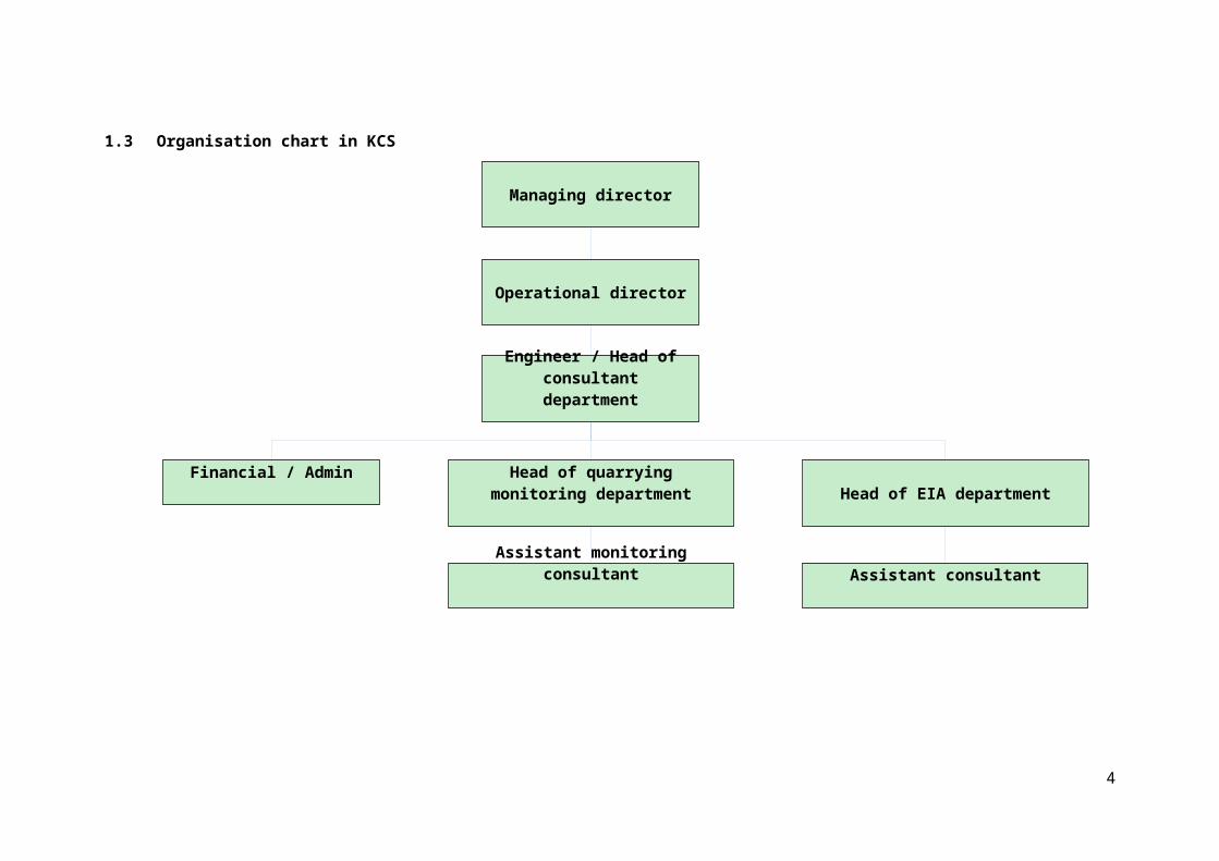
Managing director
Engineer / Head of consultant department
Financial / AdminHead of EIA department
Assistant consultant
Head of quarrying monitoring department
Assistant monitoring consultant
Operational director
1.3 Organisation chart in KCS
3
CHAPTER 2: WEEKLY ACTIVITIES SCHEDULE
Week Activities
One
Received briefing on the department by internship
supervisor
Toured around KCS office and introduction to the
staff
Translated given documents
Read given reading materials (especially the
previous EIA report)
TWO
Recorded the meeting (related with the next EIA
submit and presentation)
Received briefing on the department by KR
manager
Learned how to use Corel Draw software
Calculated the mass balances of scheduled wastes
Corrected ESCP figure (Erosion and Sedimentation
Control Plan)
Learnt on preparation of ESCP report
THREE
Continued with mass balance calculation and
ESCP report
Read previous EIA report
Prepared and drafted a new EIA report
Raya holiday
FOUR
Continued with drafting the EIA report
FIVE
Corrected the EIA report (draft) before it was sent
out by courier
4

5

Week Activities
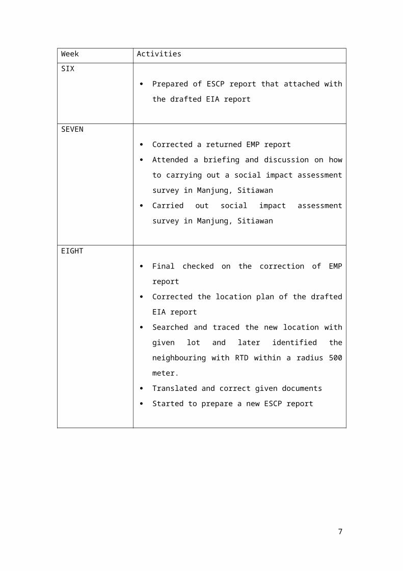
SIX
Prepared of ESCP report that attached with the
drafted EIA report
SEVEN
Corrected a returned EMP report
Attended a briefing and discussion on how to
carrying out a social impact assessment survey in
Manjung, Sitiawan
Carried out social impact assessment survey in
Manjung, Sitiawan
EIGHT
Final checked on the correction of EMP report
Corrected the location plan of the drafted EIA
report
Searched and traced the new location with given
lot and later identified the neighbouring with RTD
within a radius 500 meter.
Translated and correct given documents
Started to prepare a new ESCP report
6
CHAPTER 3: SPECIFICATION OF WORKS
3.1 Translation of documents
Most of the documents that needed to be translated from Chinese to
English were related with quarrying and mining process. These
translations are needed as the report of preliminary site inspection that
later stated and concluded in those documents was conducted by China
inspection team. The project proponents may employ the inspection team
from China for site inspection as they have experiences on geological
characteristic of the earth surface. Therefore, there is a need for
translating the terms from Chinese to English. The documents that are
needed to be translated are drawings and texts.
3.2 CorelDRAW® software
The drawing software that applied in KCS is CorelDRAW® X6 software.
Compared in the school, they did not using ArcGIS software and Erdas
software for mapping drawing. Besides, they also use CorelDRAW® and
AutoCAD for layout plan drawing instead of using Microsoft Visio.
CorelDRAW® software is a vector graphics editor developed and marketed
by Corel Corporation of Ottawa, Canada. It is also the name of Corel's
Graphics Suite, which bundles CorelDraw with bitmap-image editor Corel
Photo-Paint as well as other graphics-related programs. The most frequent
used in KCS is CorelDRAW® Graphics X6. The format set by KCS is
required when using Corel DRAW® to draw the map and figure.
7
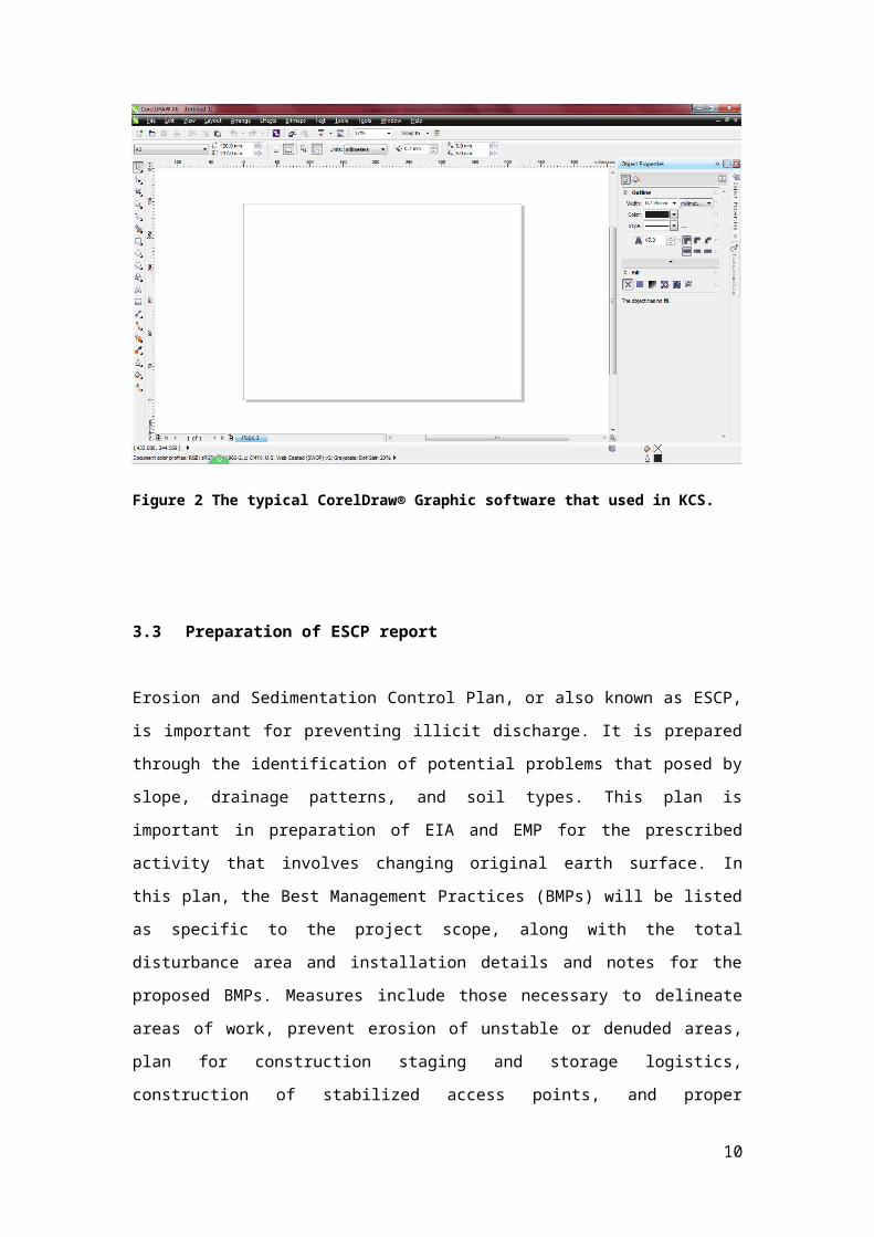
Figure 2 The typical CorelDraw® Graphic software that used in KCS.
3.3 Preparation of ESCP report
Erosion and Sedimentation Control Plan, or also known as ESCP, is
important for preventing illicit discharge. It is prepared through the
identification of potential problems that posed by slope, drainage patterns,
and soil types. This plan is important in preparation of EIA and EMP for the
prescribed activity that involves changing original earth surface. In this
plan, the Best Management Practices (BMPs) will be listed as specific to
the project scope, along with the total disturbance area and installation
details and notes for the proposed BMPs. Measures include those
necessary to delineate areas of work, prevent erosion of unstable or
denuded areas, plan for construction staging and storage logistics,
construction of stabilized access points, and proper containment measures
for construction materials and waste. Typical BMPs application may
include temporary and permanent seeding, protect areas of exposed soil,
control of runoff velocity, minimizing channel erosion, sediment trap pond
formation and others. In Malaysia, an ESCP report is prepared with the
8

proposed project concept, soil erosion modelling, and BMPs such as
sediment trap ponds design and other measures.
3.3.1 Soil erosion modelling
Soil erosion modelling is applied for predicting the anticipated amount of
soil erosion. There are a few predictive models that could be used, but the
most widely used and perhaps the most reliable method is Universal Soil
Loss Equation (USLE), which was introduced by Wishmeier and Smith in
1962. The USLE is used as a function of six factors, and each of which may
be calculated and expressed numerically. It is represented by the equation
below:
E= R.K.L.S.C.P
where,
E - Mean Annual Soil Loss
R - Rainfall Erosivity Index
K - Soil Erodibility Index
L - Slope Length Factor
S - Slope Steepness Factor
C - Vegetation/Cover Factor
Besides, Revised Universal Soil Loss Equation (RUSLE), which has the
same formula as USLE, but has several improvements in determining
factors, is also applied in soil erosion modelling. These include some new
and revised iso-erodent maps, a time-varying approach for soil erodibility
factor, a sub-factor approach for evaluating the cover-management factor,
a new equation to reflect slope length and steepness, and new
conservation-practice values (Renard et al., 1997), as shown in equation
below.
E= R.K.L.S.C.P
where,
A - Average Annual Soil Loss
R - Rainfall Erosivity Index
K - Soil Erodibility Index
L - Slope Length Factor
S - Slope Steepness Factor
9
C - Vegetation/Cover Factor
P - Soil Conservation Practice Factor
10
The Modified Universal Soil Loss Equation (MUSLE) is the most frequently
used equations in sediment yield estimation. It was introduced by Williams
(1975) to calculate sediment yields of a catchment as a result of a specific
storm event. This empirical relationship is expressed by the following
equation for individual storm events:
Y = 89.6(VQp) 0.56 (K.L.S.C.P)
where,
Y - Sediment yields per storm event (tonnes)
V - Runoff volume in cubic meter
Qp - Peak discharge in m3/s
Figure 3 The photo shown example of a completed USLE table for estimation of the potential soul erosion.
11
3.4.2 Silt trap pond design
The concept of silt trap pond (or also known as sediment trap pond)
design is based on URBAN STORMWATER MANAGEMENT MANUAL FOR
MALAYSIA 2 or also known as MSMAM 2, which published in 2012. MSMAM
2 is the latest and a good source of information on preventing erosion and
controlling sediment in runoff. A sediment basin will provide in order to
maintain in the status-quo with Average Recurrence Interval (ARI) for the
Pre and Post Development of the project.
A sediment basin (silt trap pond) is designed and constructed for the
purpose of collecting and storing sediment from sites cleared during
construction for extended periods of time before re-establishment of
permanent vegetation and/ or construction of permanent drainage
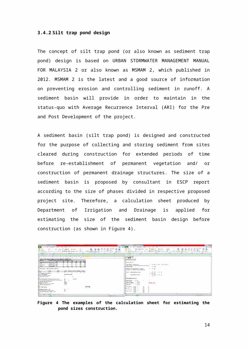
structures. The size of a sediment basin is proposed by consultant in ESCP
report according to the size of phases divided in respective proposed
project site. Therefore, a calculation sheet produced by Department of
Irrigation and Drainage is applied for estimating the size of the sediment
basin design before construction (as shown in Figure 4).
Figure 4 The examples of the calculation sheet for estimating the pond sizes construction.
12

i) ii)
iii)
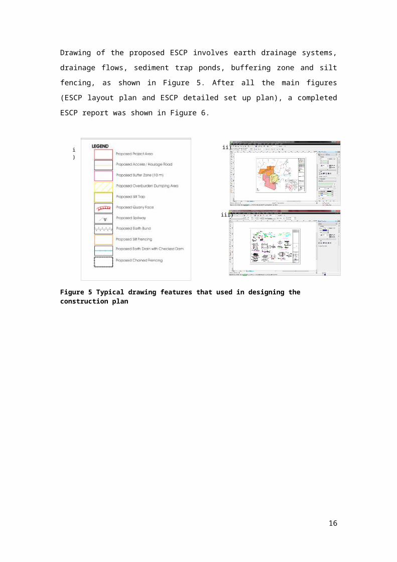
Drawing of the proposed ESCP involves earth drainage systems, drainage
flows, sediment trap ponds, buffering zone and silt fencing, as shown in
Figure 5. After all the main figures (ESCP layout plan and ESCP detailed set
up plan), a completed ESCP report was shown in Figure 6.
Figure 5 Typical drawing features that used in designing the construction plan
Figure 6 A complete ESCP report was attached with its figures which were printed in A1 size.
13
3.4 Preparation of an EIA report
Environmental Impact Assessment (EIA) is a process of evaluating the
likely environmental impacts of a proposed project or development, taking
into account inter-related socio-economic, cultural and human-health
impacts, both beneficial and adverse. UNEP defines Environmental Impact
Assessment (EIA) as a tool used to identify the environmental, social and
economic impacts of a project prior to decision-making. It aims:
i. To provide Government with advice on the environmental
acceptability of development proposals and statutory planning
schemes.
ii. To predict environmental impacts at an early stage in project
planning and design, find ways and means to reduce adverse
impacts, shape projects to suit the local environment and present
the predictions and options to decision-makers.
By using EIA both environmental and economic benefits can be achieved,
such as reduced cost and time of project implementation and design,
avoided treatment/clean-up costs and impacts of laws and regulations.
Development proposals include proposals for mining, industry as well as
infrastructure such as ports, railways and pipelines. Planning schemes
include both statutory planning schemes and their amendments. Although
the legislation of EIA enforcement is different in various, the procedure of
the EIA is conducted as follows:
i. Screening to determine which projects or developments require a
full or partial impact assessment study
ii. Scoping to identify which potential impacts are relevant to assess
(based on legislative requirements, international conventions,
expert knowledge and public involvement), to identify alternative
solutions that avoid, mitigate or compensate adverse impacts on
biodiversity (including the option of not proceeding with the
development, finding alternative designs or sites which avoid the
impacts, incorporating safeguards in the design of the project, or
14

providing compensation for adverse impacts), and finally to derive
terms of reference for the impact assessment
iii. Assessment and evaluation of impacts and development of
alternatives, to predict and identify the likely environmental impacts
of a proposed project or development, including the detailed
elaboration of alternatives;
iv. Reporting the Environmental Impact Statement (EIS) or EIA report,
including an environmental management plan (EMP), and a non-
technical summary for the general audience.
v. Review of the Environmental Impact Statement (EIS), based on the
terms of reference (scoping) and public (including authority)
participation.
vi. Decision-making on whether to approve the project or not, and
under what conditions
vii. Monitoring, compliance, enforcement and environmental auditing.
As stated in Section 34(A) of the Environmental Quality (Amendment) Act
1985, any person intending to carry out any of the prescribed activities
shall need to submit an environmental impact assessment (EIA) report to
the Director General of Department of Environment (DOE) for endorsing
before any approval for carrying out such activity can be granted by the
relevant approving authority. In Malaysia, a prescribed activity is started
with an approval of PAT (Preliminary site assessment; Penilaian Awal
Tapak), followed with EIA (Environmental Impact Assessment) and EMP
(Environmental Management Plan) before the prescribed activity is official
approved by DOE (Department of Environment). It provides a timely and
useful avenue for integrating environmental considerations into the
decision making process during the planning of a Project. For the EIA to be
effective, the following objectives will be achieved:
To collect and collate baseline data on the existing physio-chemical,
biological and socio-economic aspects of the immediate environment
in the Project area
To examine, identify, predict and assess all environmental impacts
associated with the proposed Project activities relating the operation
of the Project.
15
To specify effective mitigation measures, where required, to be
incorporated into the present operation
To identify significant residual environmental impacts, if any, and to
specify the necessary monitoring requirement.
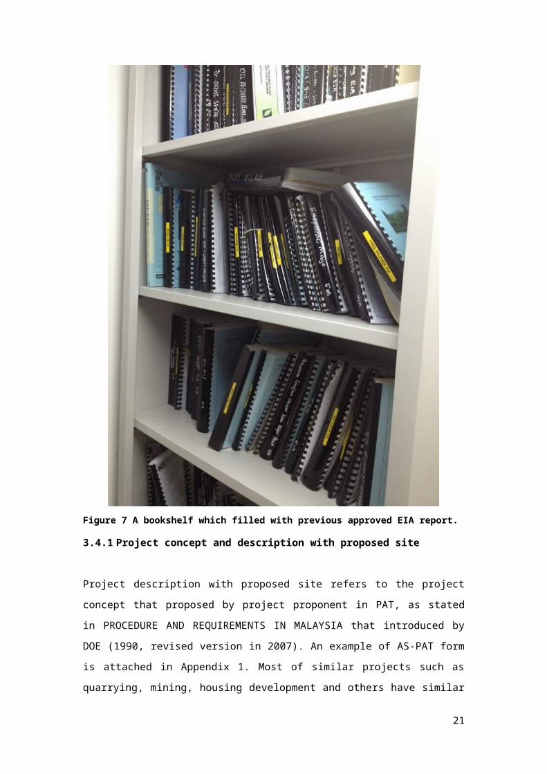
Before an EIA report writing, I was advised to review and revise the
previous approved EIA reports in the bookshelf as shown in Figure 7. This
is because KCS has its own format on EIA writing. The chapters involved in
an EIA report include declaration of the EIA team formation, description of
project proponent, details of project concepts, study of existing
environment quality status, identifying the potential impact and
appropriate environment management plan suggestion. The EIA report is
also attached with relevant documents such as land tittle or certificate of
land conversion, certificate of laboratory results, ESCP and AS-PAT
approval letter.
16
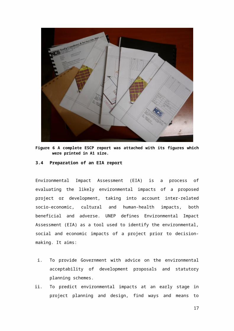
Figure 7 A bookshelf which filled with previous approved EIA report.
3.4.1 Project concept and description with proposed site
Project description with proposed site refers to the project concept that
proposed by project proponent in PAT, as stated in PROCEDURE AND
REQUIREMENTS IN MALAYSIA that introduced by DOE (1990, revised
version in 2007). An example of AS-PAT form is attached in Appendix 1.
Most of similar projects such as quarrying, mining, housing development
and others have similar concepts and descriptions on their equipment and
requirements. The minor differences among the proposed projects involve
17
site selection, site sizing, quantities and qualities of productions. A typical
project description in EIA report has:
key plan
topography plan that kindly shows the coordinate of the proposed
project site
location plan that involves using of cadastre map
layout plan of the proposed project
flow and process of the proposed project
3.4.2 Study of existing environment
Status of existing environment is important as the baseline of the current
environment quality. The physical environment and land characteristics of
the proposed Project are sourced from various published reports, maps
and field works for verification and confirmation purposes. It involves
i. Topography of the proposed project site
The topography map that used in EIA report to show the proposed
project site is Malaysian Topographic Map (Restricted).
ii. Regional geological characteristics of the site
The regional geological characteristics refer to the various types of
geological rocks and minerals distribution in Malaysia. This
investigation can be observed from the Geological Map of Malaysia
that published on 1985 by Department of Mineral and Geoscience.
iii. Soil characteristics of the site
Panton (1964) has given a broad description of Malaysian soils
where classifications have been made at the level of Great Soil
Group. Besides, more detailed description has been carried out by
Leamy and Panton (1966), as shown in Reconnaissance Soil Map
Malaysia which was amended and published on 2002.
18
iv. Weather and climate present in the site (involve humidity,
temperature, wind rose profile, and rainfall) and hydrological profile
(involve groundwater and surface water)
The data sources of the proposed project site regarding on the
weather and climate studies are usually obtained from the
meteorological station that is the nearest to the proposed project
site. The hydrological data can be achieved from the previous
research study and Department Irrigation and Drainage. These data
is important for preparing erosion and sediment control plan and
other mitigation measures.
v. Existing environmental quality monitoring (water, air and noise)
The monitoring points for monitoring the existing environment
quality of proposed project site were suggested and set with Google
Earth, Google Map and topographic map. Then, the monitoring
assessment was assigned to other department (e.g. KR laboratory
department) or other laboratories for ensuring the certification and
verification of the results. After the laboratory report was achieved,
we needed to analysis and interpret the result to observe the
current environment quality status. Typical parameters used in the
study according to the types of proposed project are listed as
follows:
19
Table 1 Typical parameter that used in monitoring the existing environment that related with respective proposed project concept
Monitori
ng area
Parameter Type of proposed project
Air Particulate matter
(PM10, PM2.5)
Gaseous (SO2, CO,
NOx, O3and etc.)
Quarrying and
mining
Industrial
Development and
construction
Water pH
Dissolved oxygen
Biochemical oxygen
demand – 5 day
(BOD5)
Chemical oxygen
demand (COD)
Ammoniacal nitrogen
(AN)
Oil and grease
Temperature
Suspended solid
Most for all prescribed
activities like quarrying
and mining, industrial
activities, development
and construction, logging
activities, and etc.
Noise - Quarrying and
mining
Industrial
Development and
construction
Traffic - Quarrying and
mining
Industrial
Development and
construction
Finally the results of the monitoring were used in modelling for
predicting future environment quality of the proposed site. This
modelling tasks was assigned to other modelling laboratory.
20
21
vi. Existing biological environment and environmentally sensitive area
Environmentally Sensitive Areas (ESAs) are land and water areas
containing natural features or ecological functions of such
significance as to warrant their protection in the best long-term
interest of the people and environment of the surrounding of the
site. The classification of ESA is according to certain criteria and
requirement such as:-
Areas that exhibit relatively high native plant and/or animal
species richness in the context of proposed project site.
Areas that provide links among two or more adjacent natural
systems.
Areas that contain plant and/or animal species that is rare
provincially or nationally.
Areas that contain representative earth science features
and/or processes typical of those which were instrumental in
creating proposed project site’s landscape.
Areas that are determined to or to be contribute significantly
to local and/or regional groundwater recharge area and
groundwater quality.
Areas that contribute to maintaining surface water quality.
These existing biological environment and ESA can be obtained
from various resources such as survey, research study or secondary
database. In KCS, the database of existing biological environment
was obtained from the previous studies of the researches and the
data that provided by the assigned statistic consultants.
vii. Existing human environment and social economics
The study of existing human environment and social economics was
achieved from the social impact assessment because the
assessment is required to understand the current social economics
in the nearest regions of the proposed project site. It is also
important for public participation in preparing EIA report.
22
viii. Existing land use and future land use
The existing land use and future land use of the proposed project
site were obtained from Local Plan (Rancangan Tempatan Daerah or
RTD) and the current Google Earth and topographic map.
This study (known as preliminary study of the site) is important as the
development of an approved proposed project can bring along the
changes and effects on the existing environment. The environmental
quality of the site and surrounding of the site will be affected and may be
degraded during the operation period. Therefore, the study of the existing
environment can help us to identify and predict the potential impacts that
may occur during the operation of the proposed activities. Finally, an
environmental management plan can be developed for mitigating the
impacts and minimizing the effects of the impacts.
3.5 Social impact assessment
Social impact assessment is a methodology to review the social effects of
infrastructure projects and other development interventions. It includes
the processes of analysing, monitoring and managing the intended and
unintended social consequences, both positive and negative, of planned
interventions (policies, programs, plans, projects) and any social change
processes invoked by those interventions. There are various types of
methodologies to conduct a social impact assessment, however, the most
frequently and typically methodologies applied are surveys and
questionnaires.
A social impact assessment survey was conducted by a survey team of 6
members in Manjung, Perak on the first day 13th August 2015 (Thursday,
from 4.00 pm to 7.00 pm) and 14th August 2015 (Friday, from 9.30 am to
6.00 pm). This assessment was conducted to review respective local
residents’ opinions on the proposed project. The study sites of the survey
23

were taken in Simpang Lima Village, Pekan Gurney and Felcra Lekir. About
sixty respondents were taken in this survey. A survey questionnaire
prepared is including basic personal social economic details, their opinion
and perspectives on the coming proposed project, and their health aspect.
Figure 8 Location maps of the study areas during social impact assessment survey
Simpang Lima Village (Kampung Simpang Lima) is a small village that
established after Second World War. Population of the village is about a
thousand people. The basic infrastructures and facilities in the village
consist of a public hall, few shop lots, a grass field and a primary school.
The level education among the villagers are categorised in primary and
secondary school level. Agriculture activities and small business (grocery
shop) are the main source of social economic in the village.
24
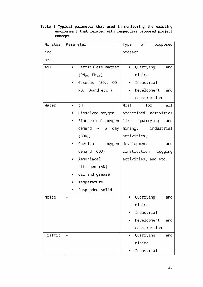
Figure 9 Kampung Simpang Lima
Pekan Gurney or Gurney's Town is a small town in Perak, Malaysia. This
town was founded in 1952 and named after Sir Henry Gurney, a former
British High Commissioner in Malaya. Chinese settlement is mainly found
in this town. The basic infrastructures and facilities in the village consist of
a public hall, shop lots, a grass field and school. The level education
among the villagers are categorised in primary and secondary school level.
Agriculture activities like rubber tappers, pig farmers and padi planters
and small scale commercial activities like grocery shop are the main
source of social economic in the village.
Figure 10 Pekan Gurney
25

Felcra Lekir (Kampung Simpang Lima) is a Malay Settlement that
established under Rancangan Tanah Belia in Sitiawan, Perak. Population
of the village is about a thousand people. The basic infrastructures and
facilities in the village consist of a public hall, few shop lots, a grass field
and a primary school. The level education among the villagers are
categorised in secondary school level and university level. Agriculture
activities and small business (grocery shop) are the main source of social
economic in the village.
Figure 11 Entrance of Kampung Felcra Lekir
26
Figure 12 A residential house in Kampung Felcra Lekir
From the survey, majority of respondents gave positive perspectives on
the coming proposed project. Minority of respondents did not give any
perspectives on the proposed project as they stated that they did not have
any idea on the proposed project. Some of the respondents gave negative
perspectives on the proposed project according to social economic status
in their region. The survey results were then passed to an assigned
statistic consultant for further analysis and interpretation.
27