hidrogeologi & air bawah tanah (hydrogeology and groundwater)
DESCRIPTION
Hidrogeologi & Air Bawah Tanah (Hydrogeology and Groundwater). Star 5 Ogos 2003. Kita sudah bincang mengenai. Mineral Batuan Tanah Now AIR pulak. Objectives. Memahami perbezaan bidang hidrogeologi dgn hidrologi Meninjau sumber air dan kitar air - PowerPoint PPT PresentationTRANSCRIPT
Hidrogeologi & Air Bawah Tanah
(Hydrogeology and Groundwater)
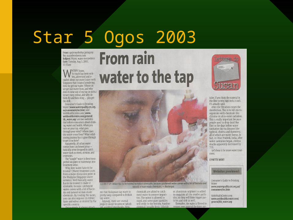
Star 5 Ogos 2003
Kita sudah bincang mengenai
1. Mineral
2. Batuan
3. Tanah
4. Now AIR pulak
Objectives• Memahami perbezaan bidang hidrogeologi
dgn hidrologi
• Meninjau sumber air dan kitar air
• Memahami konsep asas: keliangan (porosity), ketelapan (permeability), akuifer, akuitard, akuiklud.
• Memahami konsep paras air dan faktor yg mengawal kedudukannya
• Describe the character and behaviour of groundwater in various settings
• Discuss environmental problems related to groundwater.
Hydrogeology vs hydrology
• Sama saja dalam segala segi
• Kalau beza sikit sangat
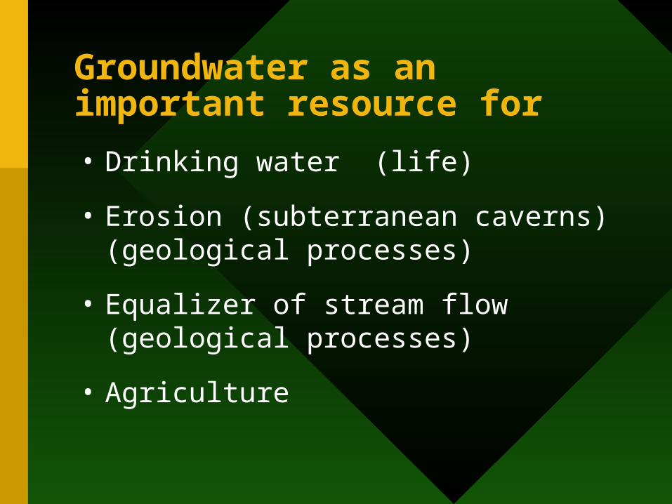
Groundwater as an important resource for
• Drinking water (life)
• Erosion (subterranean caverns) (geological processes)
• Equalizer of stream flow (geological processes)
• Agriculture
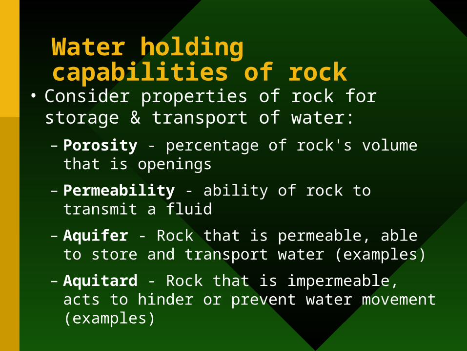
Water holding capabilities of rock
• Consider properties of rock for storage & transport of water:
– Porosity - percentage of rock's volume that is openings
– Permeability - ability of rock to transmit a fluid
– Aquifer - Rock that is permeable, able to store and transport water (examples)
– Aquitard - Rock that is impermeable, acts to hinder or prevent water movement (examples)
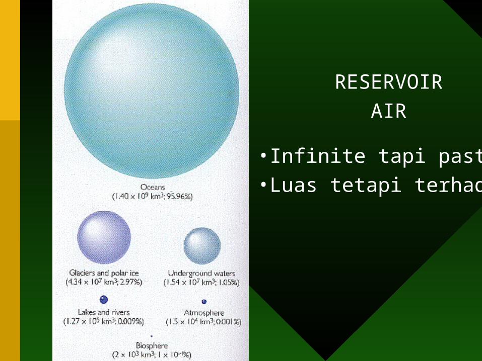
RESERVOIR
AIR
•Infinite tapi pasti
•Luas tetapi terhad
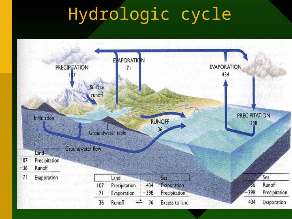
Hydrologic cycle
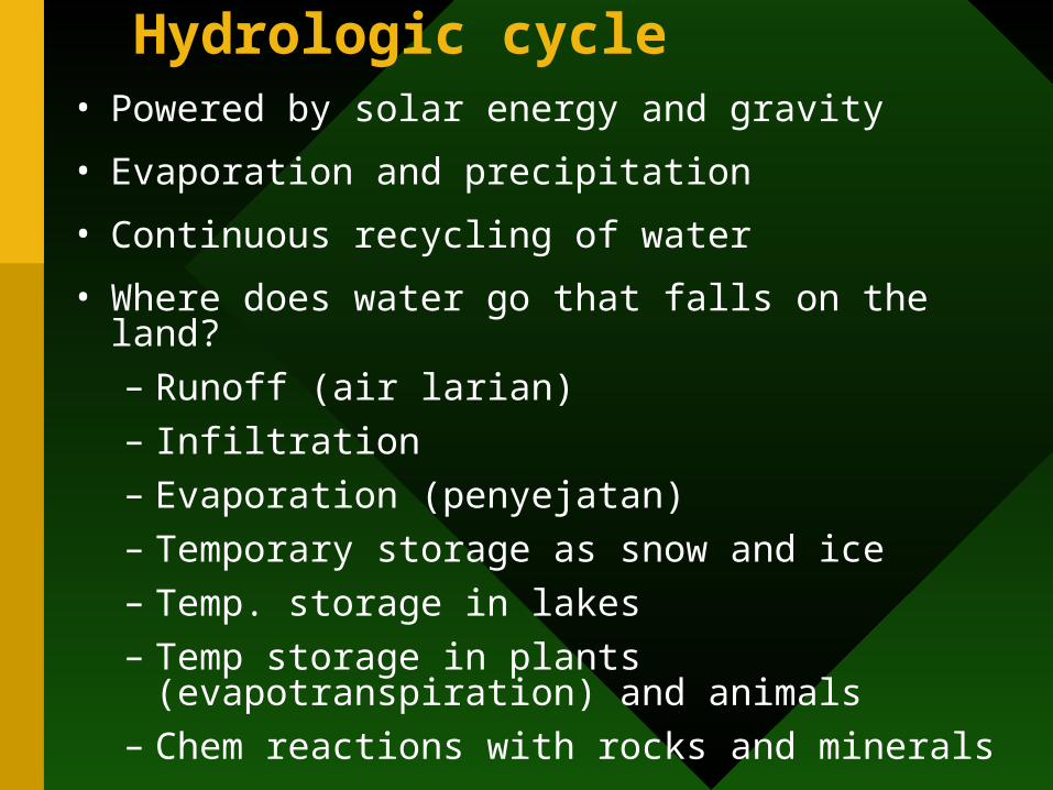
Hydrologic cycle• Powered by solar energy and gravity
• Evaporation and precipitation
• Continuous recycling of water
• Where does water go that falls on the land?
– Runoff (air larian)
– Infiltration
– Evaporation (penyejatan)
– Temporary storage as snow and ice
– Temp. storage in lakes
– Temp storage in plants (evapotranspiration) and animals
– Chem reactions with rocks and minerals
• Source of additional water? volcanism (steam)
–Volcanism also causes melting of snow caps and mudflows as meltwater mixes with ash
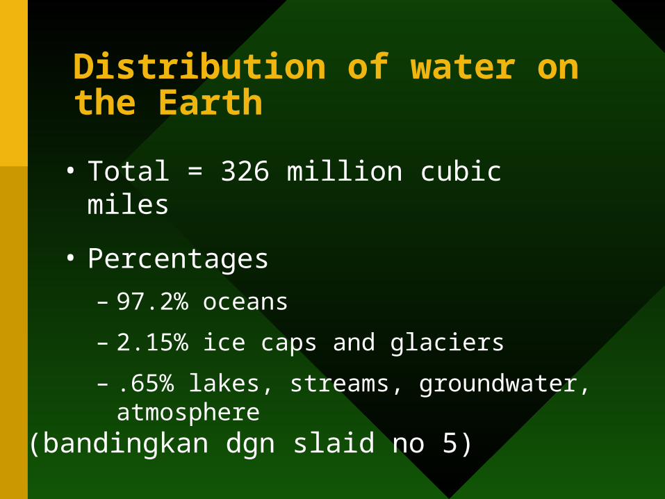
Distribution of water on the Earth
• Total = 326 million cubic miles
• Percentages
– 97.2% oceans
– 2.15% ice caps and glaciers
– .65% lakes, streams, groundwater, atmosphere
(bandingkan dgn slaid no 5)
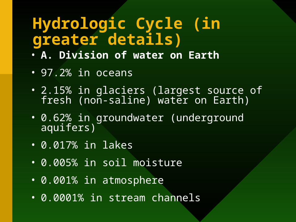
Hydrologic Cycle (in greater details)• A. Division of water on Earth
• 97.2% in oceans
• 2.15% in glaciers (largest source of fresh (non-saline) water on Earth)
• 0.62% in groundwater (underground aquifers)
• 0.017% in lakes
• 0.005% in soil moisture
• 0.001% in atmosphere
• 0.0001% in stream channels
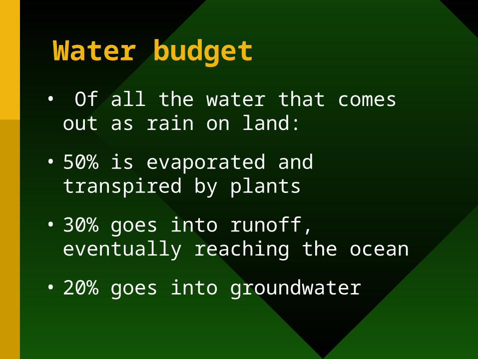
Water budget
• Of all the water that comes out as rain on land:
• 50% is evaporated and transpired by plants
• 30% goes into runoff, eventually reaching the ocean
• 20% goes into groundwater
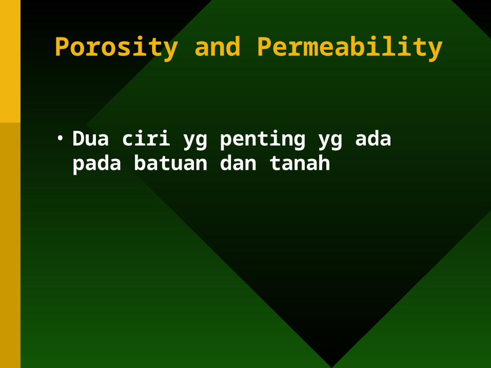
Porosity and Permeability
• Dua ciri yg penting yg ada pada batuan dan tanah
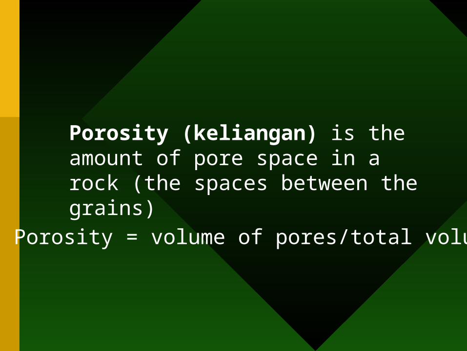
Porosity (keliangan) is the amount of pore space in a rock (the spaces between the grains)
Porosity = volume of pores/total volume
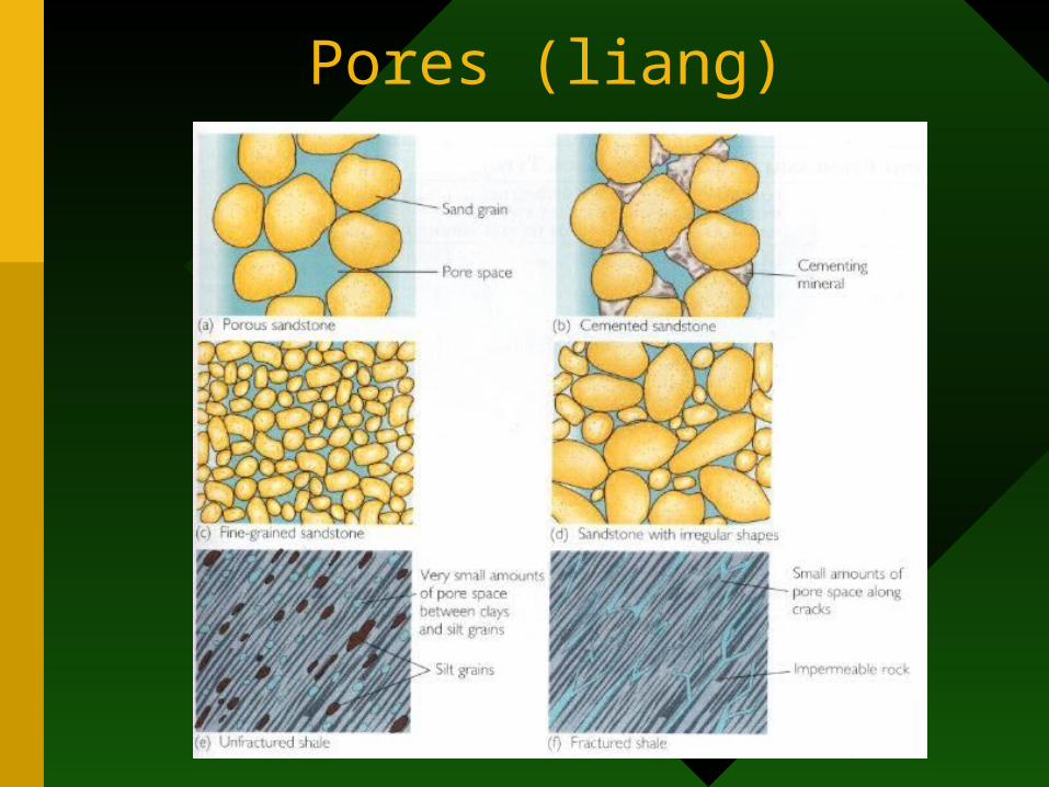
Pores (liang)
Tazkirah/peringatan
• Tahukah anda semua jenis batuan mendak, igneus dan metamorfik?
• Tahukah anda ciri2 asas pada ketiga-tiga jenis batuan tersebut? (struktur kimia, sifat fizik dan kimia, proses kejadiannya/pembentukkannya)
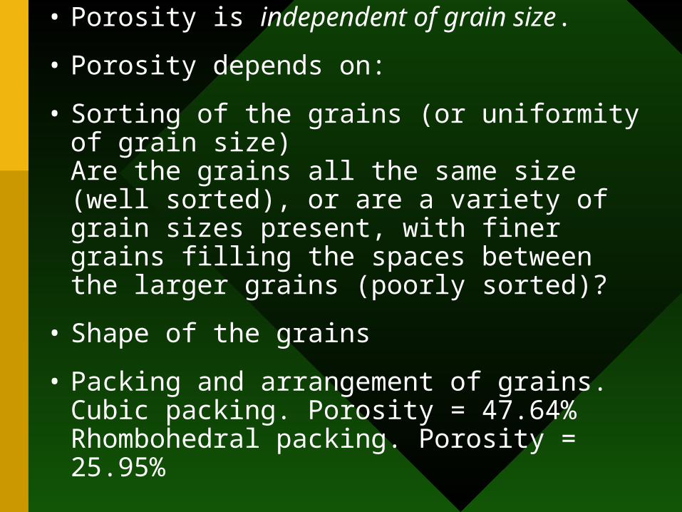
• Porosity is independent of grain size.
• Porosity depends on:
• Sorting of the grains (or uniformity of grain size)Are the grains all the same size (well sorted), or are a variety of grain sizes present, with finer grains filling the spaces between the larger grains (poorly sorted)?
• Shape of the grains
• Packing and arrangement of grains.Cubic packing. Porosity = 47.64%Rhombohedral packing. Porosity = 25.95%
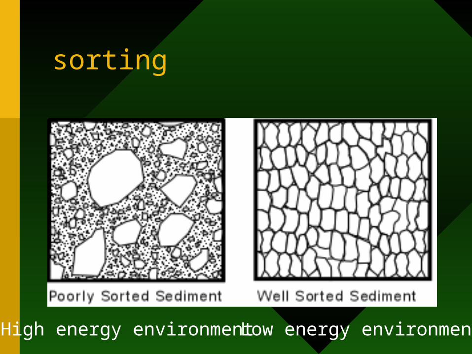
sorting
High energy environment Low energy environment

Packing?
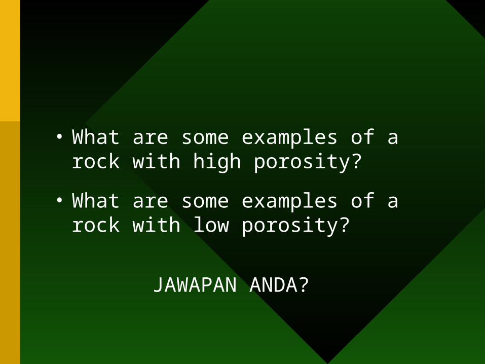
• What are some examples of a rock with high porosity?
• What are some examples of a rock with low porosity?
JAWAPAN ANDA?
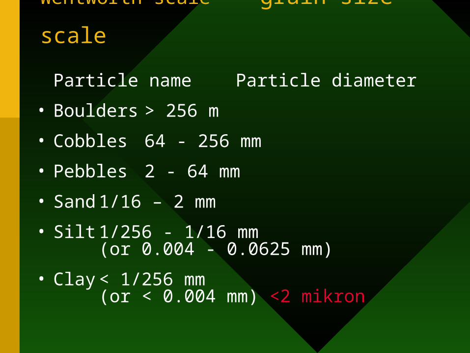
Wentworth scale - grain size scale
Particle name Particle diameter
• Boulders > 256 m
• Cobbles 64 - 256 mm
• Pebbles 2 - 64 mm
• Sand 1/16 – 2 mm
• Silt 1/256 - 1/16 mm (or 0.004 - 0.0625 mm)
• Clay < 1/256 mm (or < 0.004 mm) <2
mikron
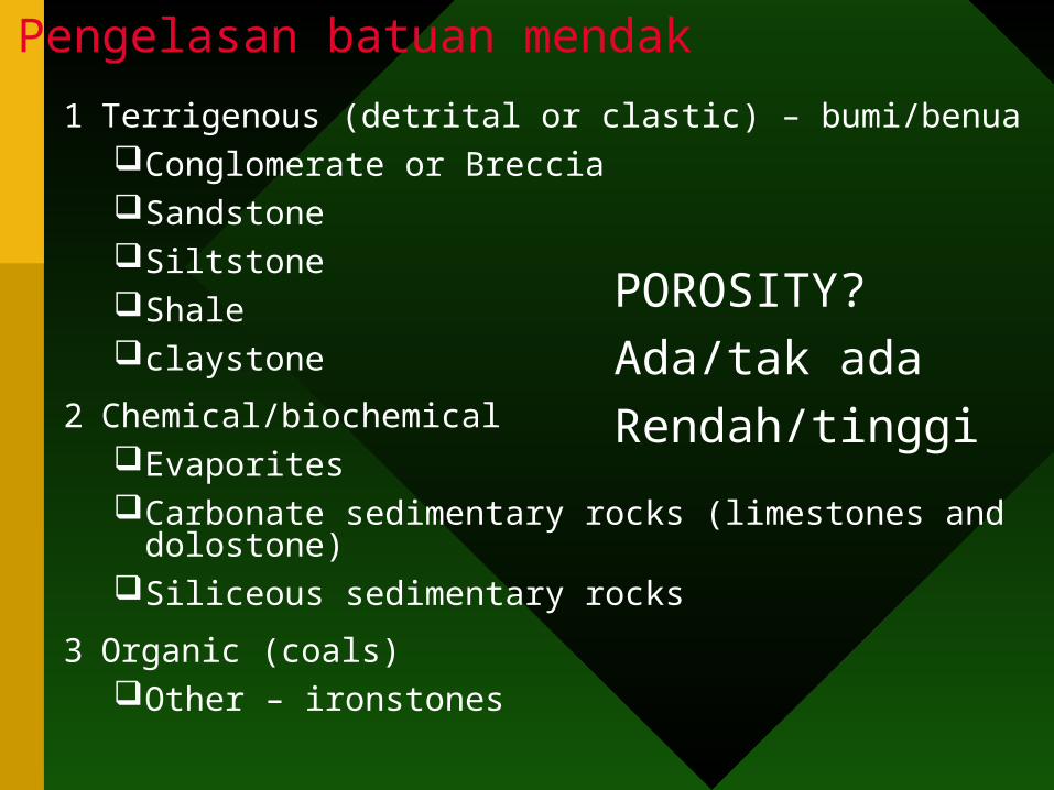
1 Terrigenous (detrital or clastic) – bumi/benuaConglomerate or Breccia Sandstone Siltstone Shale claystone
2 Chemical/biochemical Evaporites Carbonate sedimentary rocks (limestones and dolostone) Siliceous sedimentary rocks
3 Organic (coals) Other – ironstones
Pengelasan batuan mendak
POROSITY?
Ada/tak ada
Rendah/tinggi
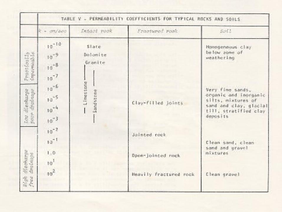
Permeability (ketelapan) is the ease with which fluids flow through a rock or sediment
• A rock is permeable if fluids pass through it, and impermeable if fluid flow through the rock is negligible
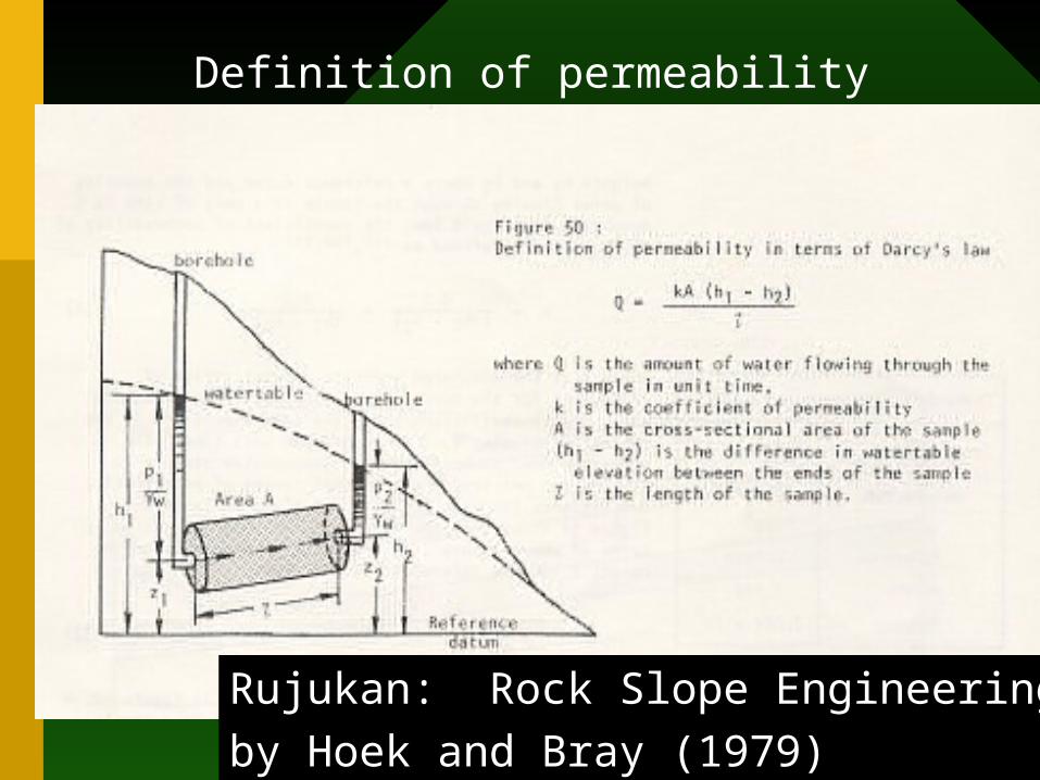
Definition of permeability
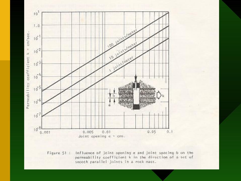
Rujukan: Rock Slope Engineering
by Hoek and Bray (1979)
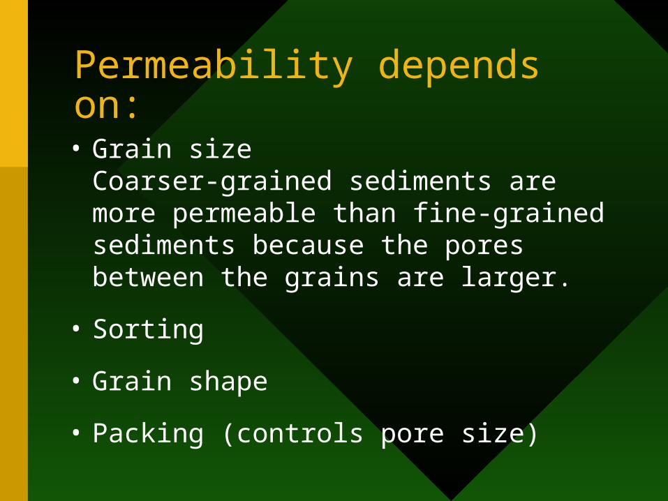
Permeability depends on:
• Grain sizeCoarser-grained sediments are more permeable than fine-grained sediments because the pores between the grains are larger.
• Sorting
• Grain shape
• Packing (controls pore size)

• What are some examples of a rock with high permeability?
• What are some examples of a rock with low permeability?
JAWAPAN ANDA?
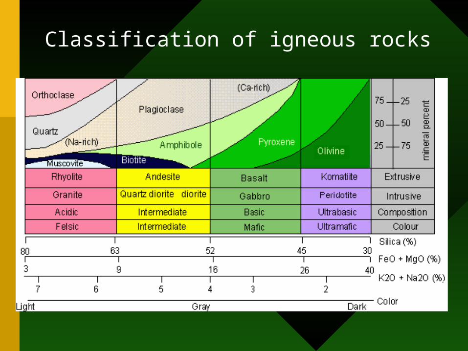
Classification of igneous rocks
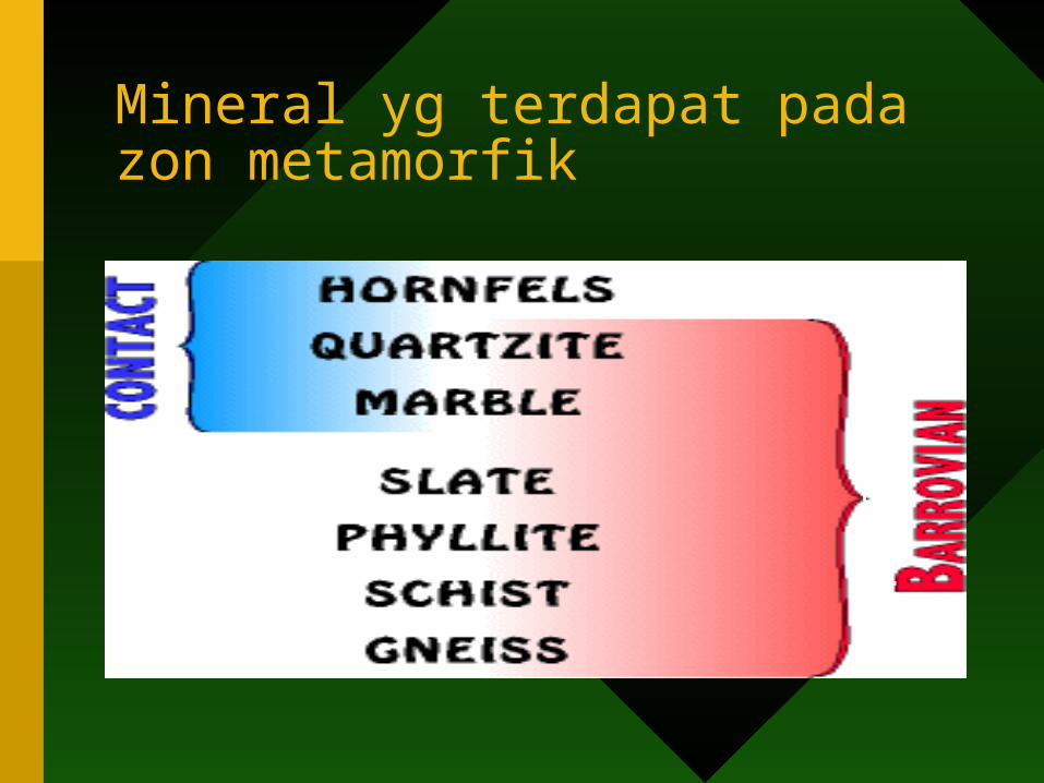
Mineral yg terdapat pada zon metamorfik
RE
GIO
NA
L

Changes that occur in the transformation to become metamorphic rocks
Rumus
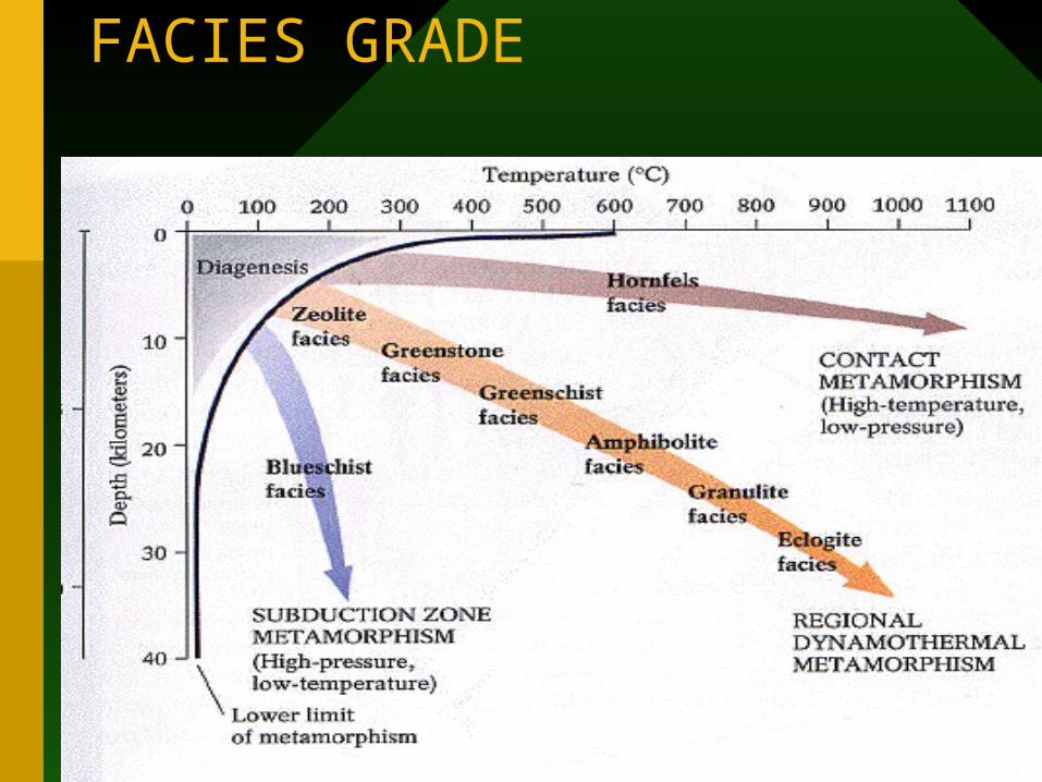
FACIES GRADE
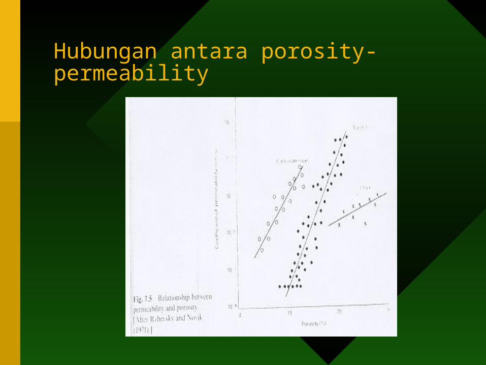
Hubungan antara porosity-permeability
• AQUIFER, AQUICLUDES, WATER TABLE, UNCONFINED, CONFINED AND PERCHED WATERS
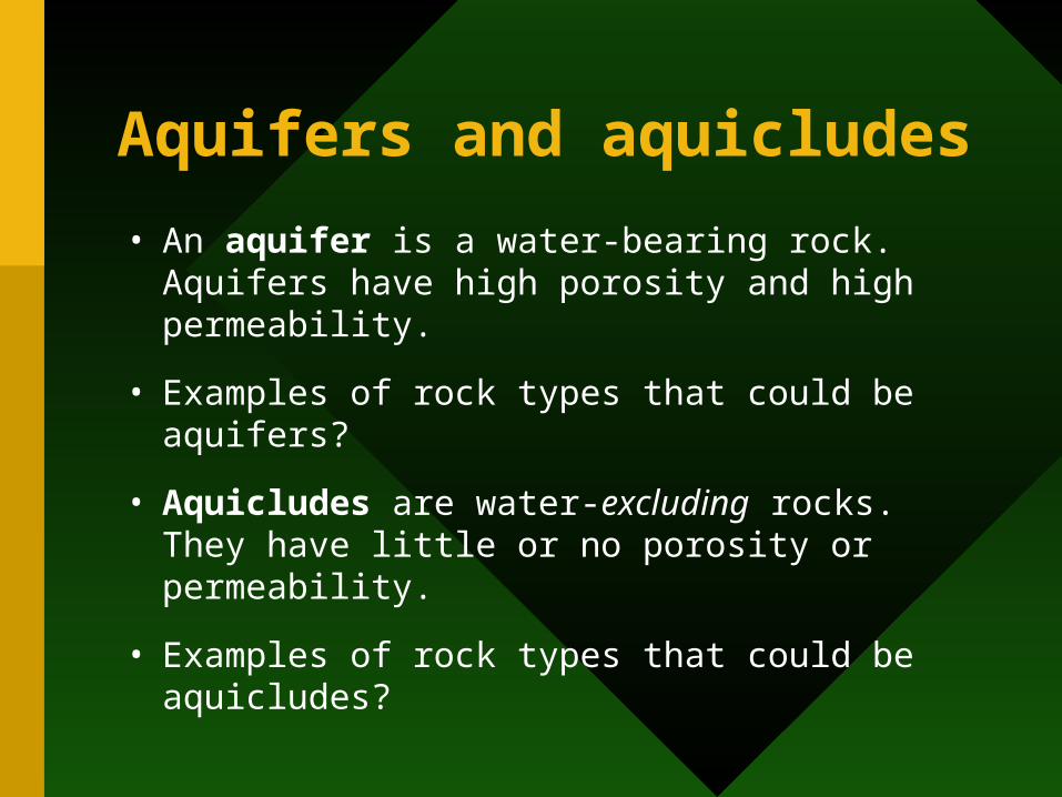
Aquifers and aquicludes
• An aquifer is a water-bearing rock. Aquifers have high porosity and high permeability.
• Examples of rock types that could be aquifers?
• Aquicludes are water-excluding rocks.They have little or no porosity or permeability.
• Examples of rock types that could be aquicludes?
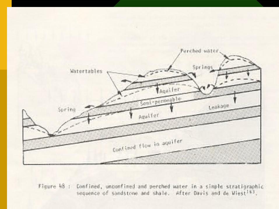
• Note that some impermeable rock types may serve as aquifers if they are highly jointed. Water may be in the joints or cracks in the rock
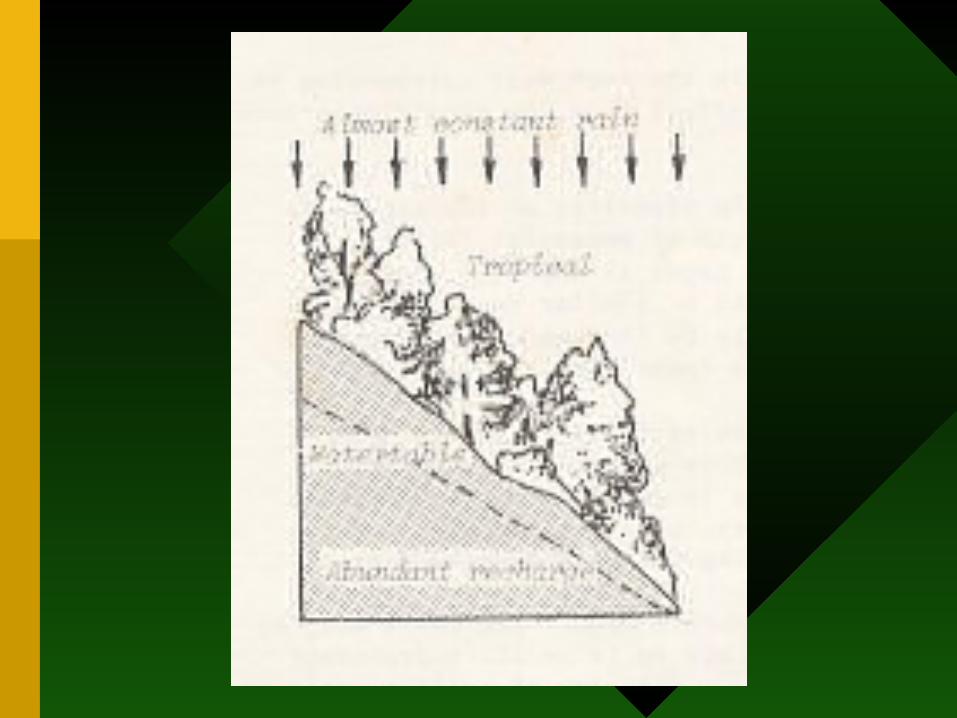
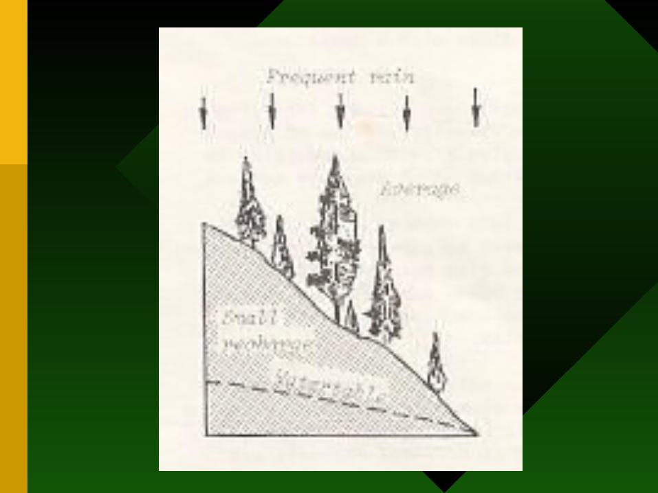
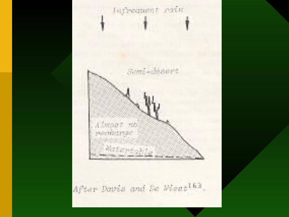
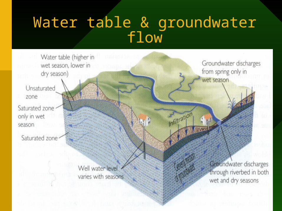
Water table/Paras air
•Bergantung kpd topografi
Water table
The Water Table (Paras air)
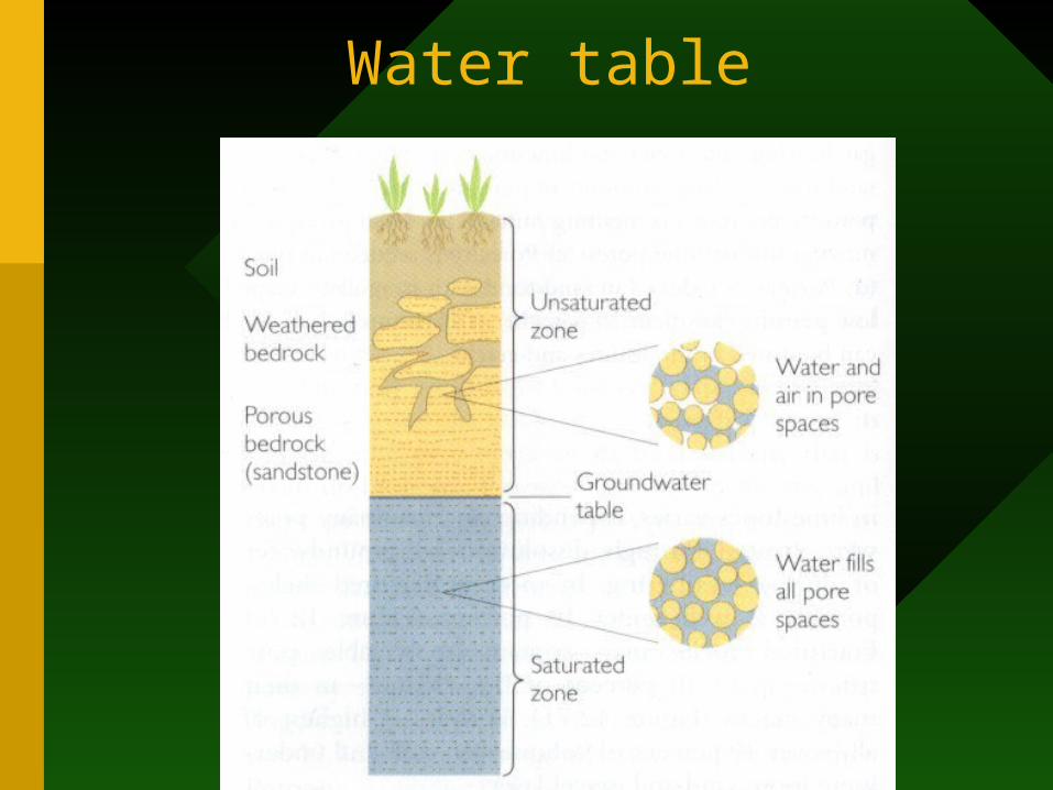
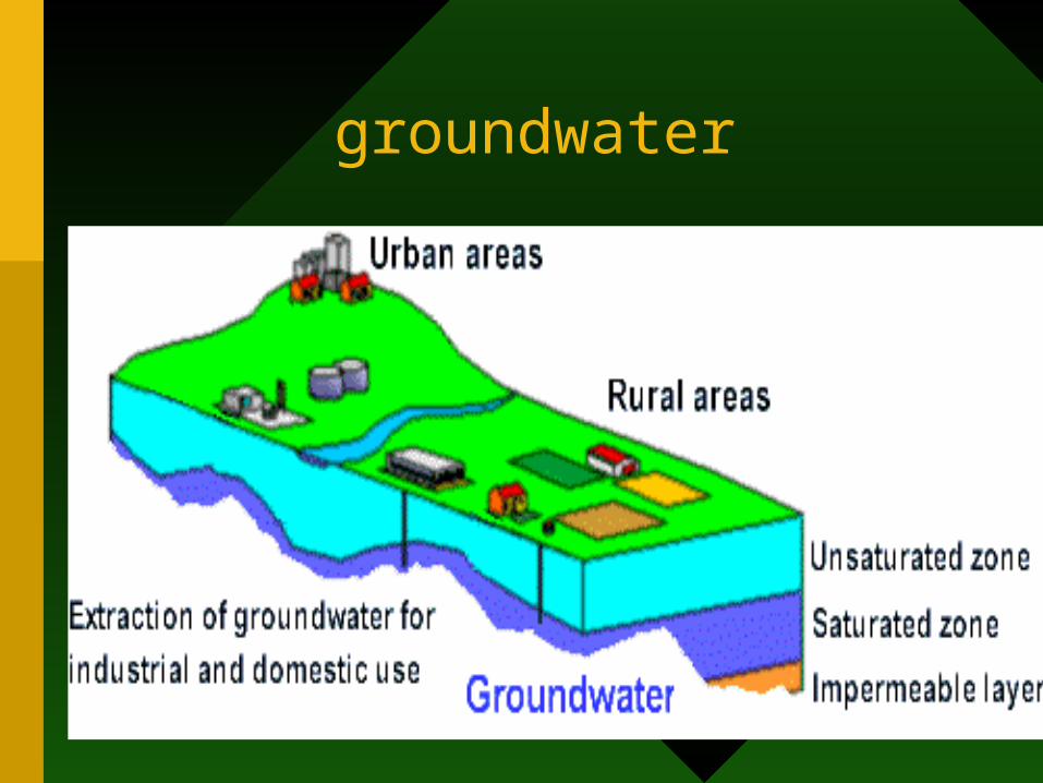
• When it rains, some of the water percolates or soaks into the ground. We call this infiltration. Some of the water is held in the soil because it clings to the soil particles because of molecular attraction. It may evaporate from the soil or be used by plants (zone of aeration, also called the vadose zone). Both air and water occupy the pores spaces.
• Excess water penetrates downward until it reaches the water table. Below this point, all of the pore spaces are filled with water (zone of saturation (ZON TEPU), also called the phreatic zone).
• The water table is the top of the zone of saturation.
• The water table is not flat. It mimics the topography, but is more subdued. It stands somewhat higher under hills, and lower under valleys.
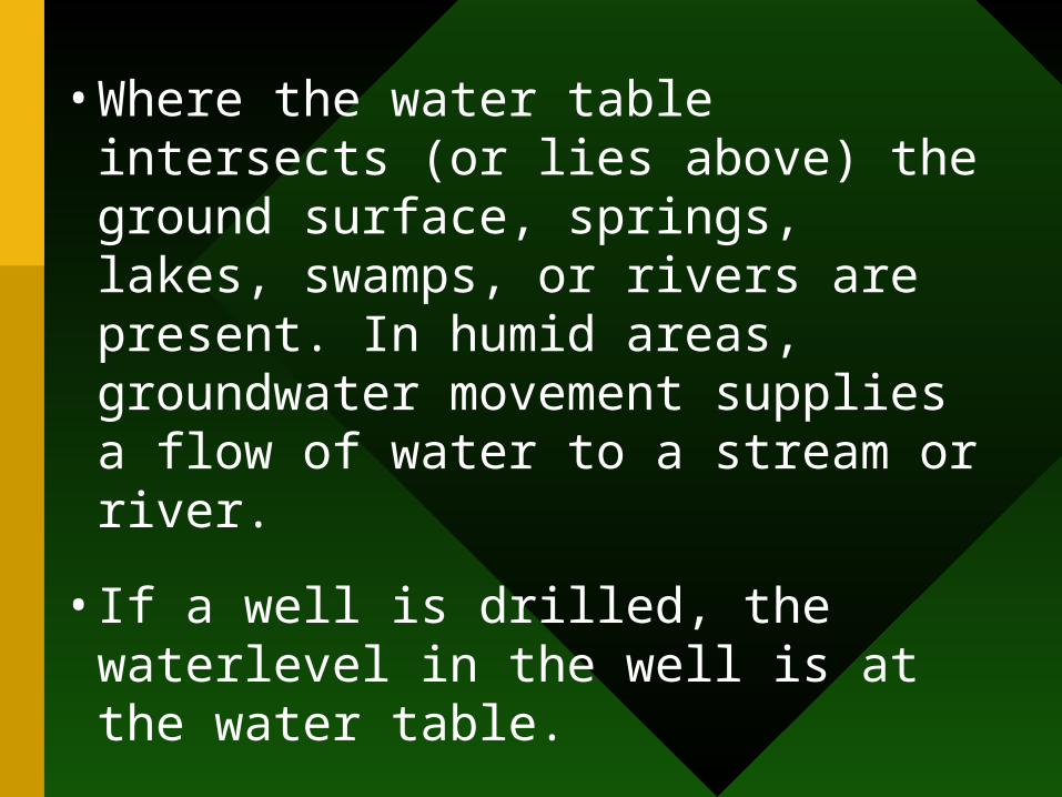
• Where the water table intersects (or lies above) the ground surface, springs, lakes, swamps, or rivers are present. In humid areas, groundwater movement supplies a flow of water to a stream or river.
• If a well is drilled, the waterlevel in the well is at the water table.
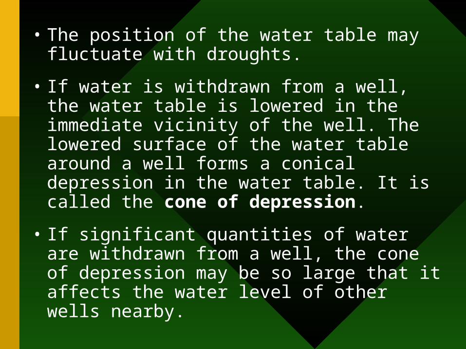
• The position of the water table may fluctuate with droughts.
• If water is withdrawn from a well, the water table is lowered in the immediate vicinity of the well. The lowered surface of the water table around a well forms a conical depression in the water table. It is called the cone of depression.
• If significant quantities of water are withdrawn from a well, the cone of depression may be so large that it affects the water level of other wells nearby.
Water table & groundwater flow
Processes
• Recharge-precipitation and infiltration
• Discharge-rivers, runoff, pumping
• Relation to topography
• Relation to seasonality
Water table & groundwater flow
groundwater
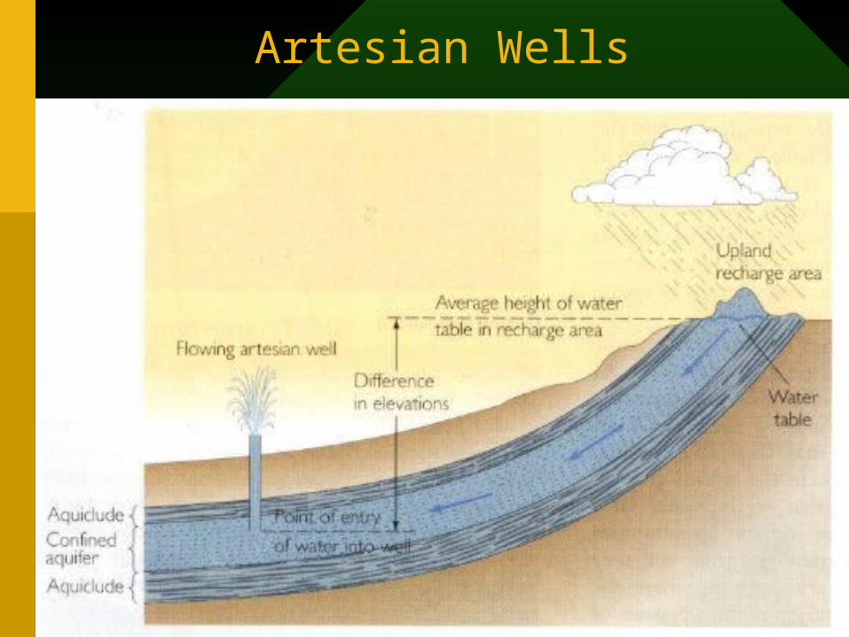
Artesian Wells
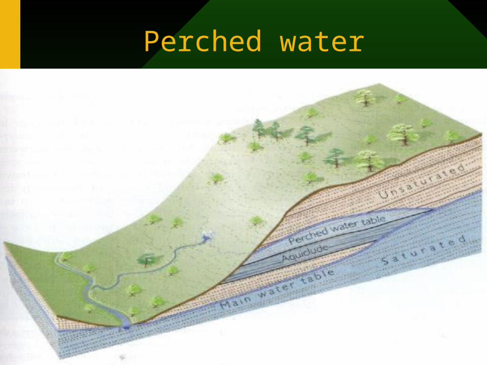
Perched water
Groundwater as resource
• Seasonal changes
• Effects of pumping
• Pollution of groundwater
• Ogallala aquifer
Problems associated with groundwater withdrawal
• Ground water depletion
• Subsidence
• Sinkhole formation
• Groundwater pollution or contamination
• Saltwater encroachment
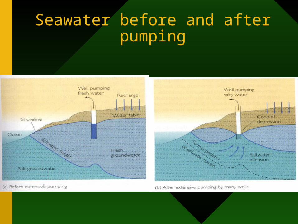
Seawater before and after pumping
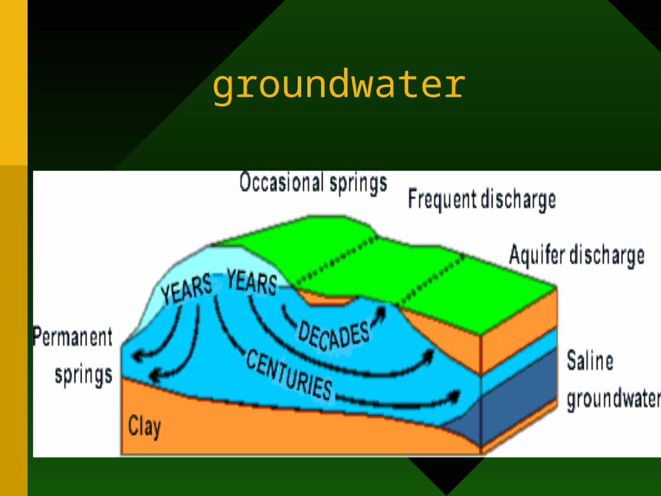
groundwater
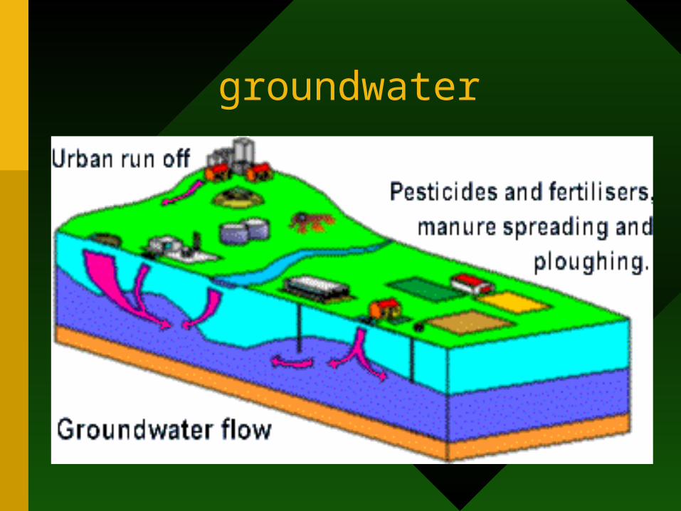
groundwater
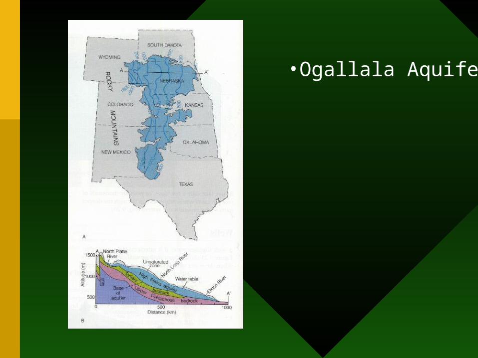
•Ogallala Aquifer
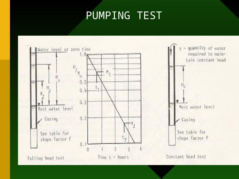
PUMPING TEST
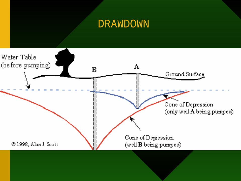
DRAWDOWN
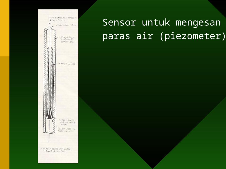
Sensor untuk mengesan
paras air (piezometer)