#10 - landslide - universiti kebangsaan · pdf fileengineering spec –diverted stream ......
TRANSCRIPT
drwzwy::2010
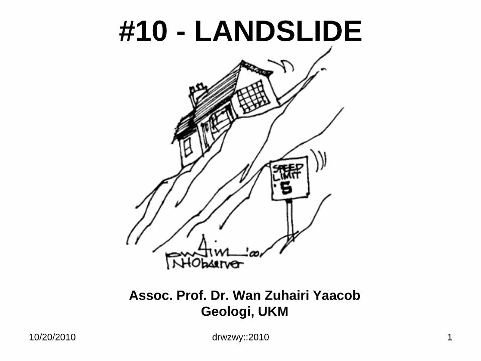
#10 - LANDSLIDE
Assoc. Prof. Dr. Wan Zuhairi Yaacob
Geologi, UKM
10/20/2010 1
drwzwy::2010
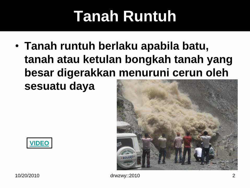
Tanah Runtuh
• Tanah runtuh berlaku apabila batu,
tanah atau ketulan bongkah tanah yang
besar digerakkan menuruni cerun oleh
sesuatu daya
10/20/2010 2
VIDEO
Istilah tanah runtuh
drwzwy::2010
• Tanah runtuh (Landslide)
• Kestabilan cerun (Slope stability)
• Ketidakstabilan cerun (Slope instability)
• Kegagalan cerun (slope failure)
• Pergerakan jisim / susutan darat (Mass
movement / Mass wasting)
• Gelinciran tanah (Landslip)
• Subsidence
• Lubang benam (Sinkhole)
• Pemendapan tanah (Settlement)
10/20/2010 3

Kestabilan cerun
1. Peranan bahan bumi (earth material
type)
2. Daya-daya pada cerun (forces on
slopes)
3. Peranan sudut cerun dan topografi
4. Peranan cuaca dan tumbuhan
5. Peranan Air
6. Peranan Masa
10/20/2010 drwzwy::2010 4
drwzwy::2010
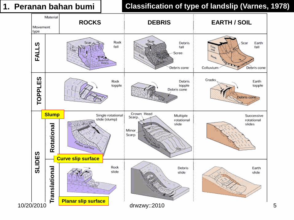
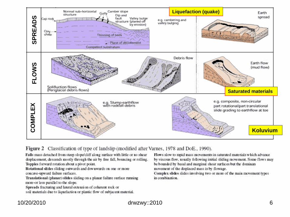
Classification of type of landslip (Varnes, 1978)
Slump
Curve slip surface
Planar slip surface10/20/2010
1. Peranan bahan bumi
Ro
tati
on
al
Tra
ns
lati
on
al
SL
IDE
ST
OP
PL
ES
FA
LL
S
ROCKS DEBRIS EARTH / SOIL
5
drwzwy::2010
Saturated materials
10/20/2010
Liquefaction (quake)
SP
RE
AD
SF
LO
WS
CO
MP
LE
X
Koluvium
6
10/20/2010 drwzwy::2010 7
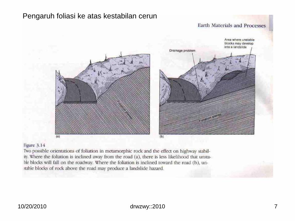
Pengaruh foliasi ke atas kestabilan cerun
2. Daya pada cerun
• Driving forces (daya penyebab) – F1
– Move earth material down a slope
– Eg: weight of earth material (w)
• Resisting forces (daya penahan) – F2
– Oppose such movement
– Eg: shear strength of slope material
drwzwy::2010
Factor of safety, FS (faktor keselamatan)
• Nisbah antara daya penahan
terhadap daya penyebab gelinciran
• FS > 1 (stabil) ; F2 > F1
• FS < 1 (gagal) ; F1 > F2
F1
F2
10/20/2010
w
8
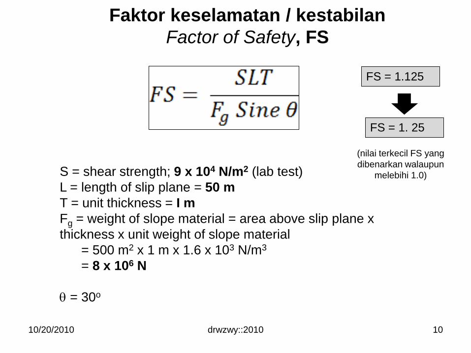
Faktor keselamatan / kestabilan
Factor of Safety, FS
drwzwy::2010
Fn
Fg
Fs
Gravity force
Shear force
(daya ricih)
Normal force
•The shear force acts to pull
the block down the plane.
•Normal force acts to
increase friction and stick
the block to the plane.
Fs; Fn
Fs = Fg Sin
Fn = Fg Cos
L
T
S – shear strength
A
10/20/2010 9
10/20/2010 drwzwy::2010
S = shear strength; 9 x 10⁴ N/m2 (lab test)
L = length of slip plane = 50 m
T = unit thickness = I m
Fg = weight of slope material = area above slip plane x
thickness x unit weight of slope material
= 500 m2 x 1 m x 1.6 x 103 N/m3
= 8 x 10⁶ N
= 30o
FS = 1.125
FS = 1. 25
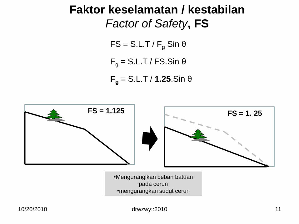
Faktor keselamatan / kestabilan
Factor of Safety, FS
(nilai terkecil FS yang
dibenarkan walaupun
melebihi 1.0)
10
10/20/2010 drwzwy::2010
FS = 1. 25
FS = S.L.T / Fg Sin θ
Fg = S.L.T / FS.Sin θ
Fg = S.L.T / 1.25.Sin θ
•Menguranglkan beban batuan
pada cerun
•mengurangkan sudut cerun
Faktor keselamatan / kestabilan
Factor of Safety, FS
FS = 1.125
11
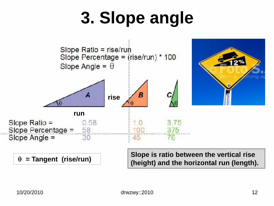
3. Slope angle
drwzwy::2010
= Tangent (rise/run)
10/20/2010
Slope is ratio between the vertical rise
(height) and the horizontal run (length).
rise
run
12
drwzwy::2010
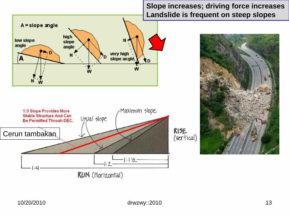
Slope increases; driving force increases
Landslide is frequent on steep slopes
10/20/2010
Cerun tambakan
13
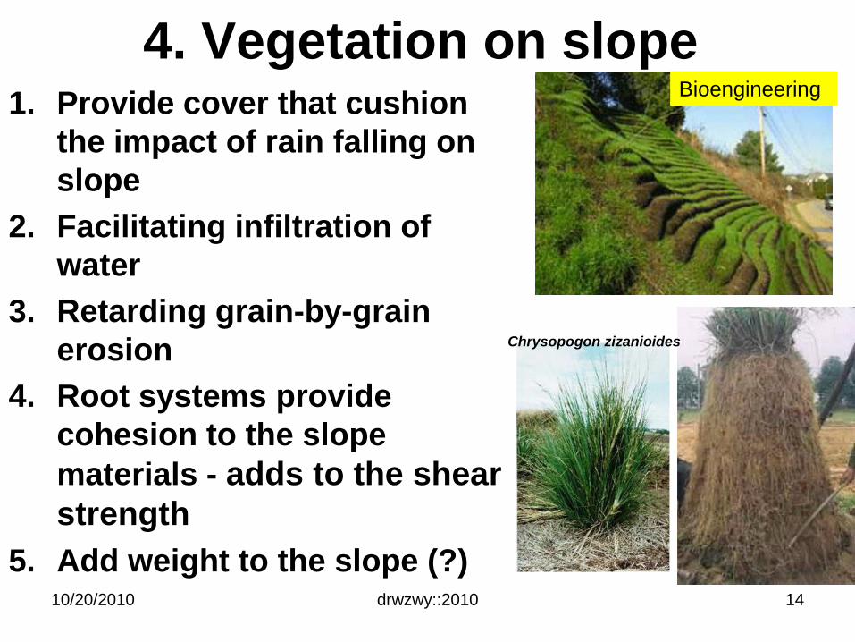
4. Vegetation on slope1. Provide cover that cushion
the impact of rain falling on
slope
2. Facilitating infiltration of
water
3. Retarding grain-by-grain
erosion
4. Root systems provide
cohesion to the slope
materials - adds to the shear
strength
5. Add weight to the slope (?)drwzwy::201010/20/2010 14
Bioengineering
Chrysopogon zizanioides
5. Peranan air1. Chemical weathering – reduce shear
strength (cth: batu kapur vs asid lemah)
2. Erosion ability of water
3. Rise in pore water pressure; reduce
the shear strength (resisting force) &
increase the weight (driving force)
4. Liquefaction of clay rich sediment
(quick/sensitive clay)- earthquake
triggered
5. Seepage of water from artificial
sources – eg. St. Francis Dam
– Perlarutan bahan simen dalam batuan
iaitu konglomerate & gypsum
drwzwy::201010/20/2010 15
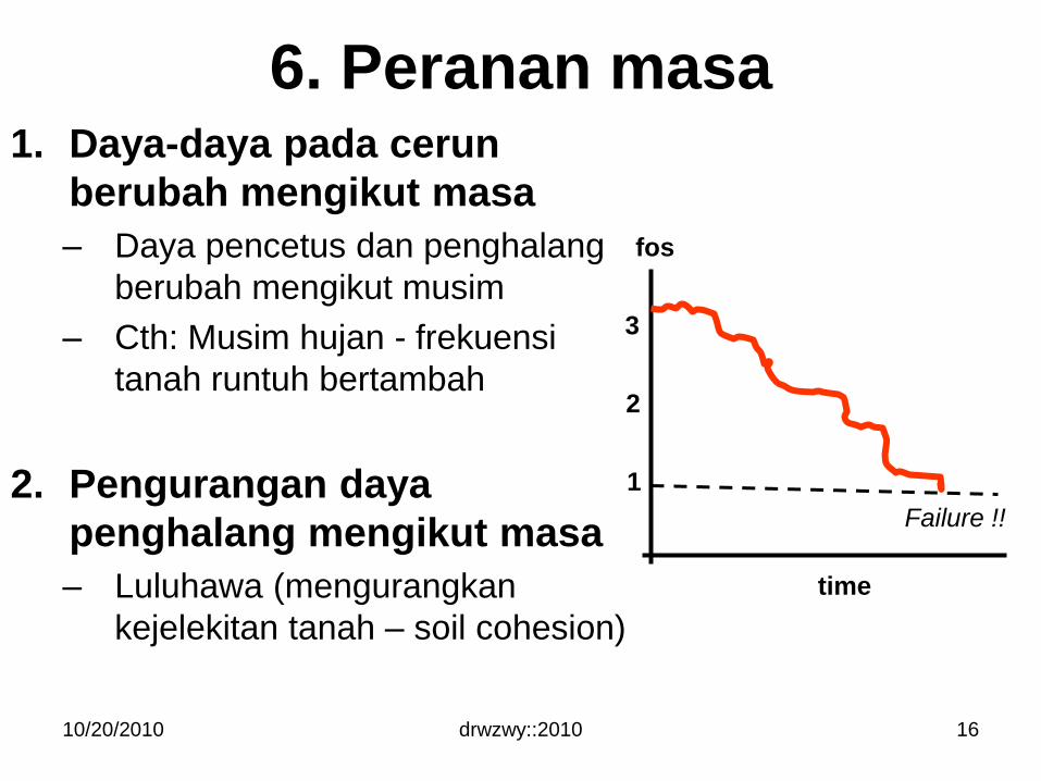
6. Peranan masa1. Daya-daya pada cerun
berubah mengikut masa
– Daya pencetus dan penghalang
berubah mengikut musim
– Cth: Musim hujan - frekuensi
tanah runtuh bertambah
2. Pengurangan daya
penghalang mengikut masa
– Luluhawa (mengurangkan
kejelekitan tanah – soil cohesion)
10/20/2010 drwzwy::2010 16
fos
time
1
2
3
Failure !!
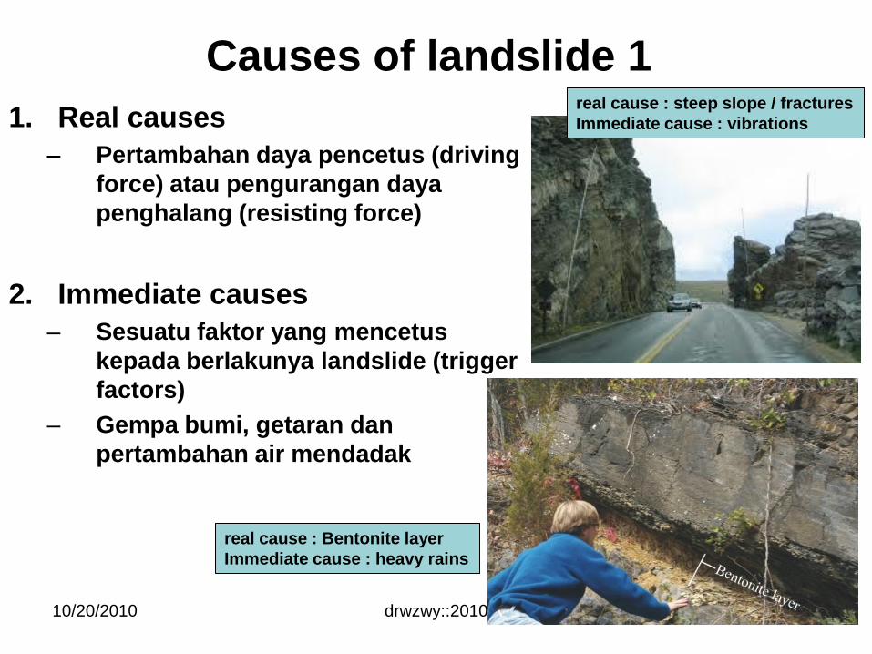
Causes of landslide 1
1. Real causes
– Pertambahan daya pencetus (driving
force) atau pengurangan daya
penghalang (resisting force)
2. Immediate causes
– Sesuatu faktor yang mencetus
kepada berlakunya landslide (trigger
factors)
– Gempa bumi, getaran dan
pertambahan air mendadak
drwzwy::201010/20/2010 17
real cause : Bentonite layer
Immediate cause : heavy rains
real cause : steep slope / fractures
Immediate cause : vibrations
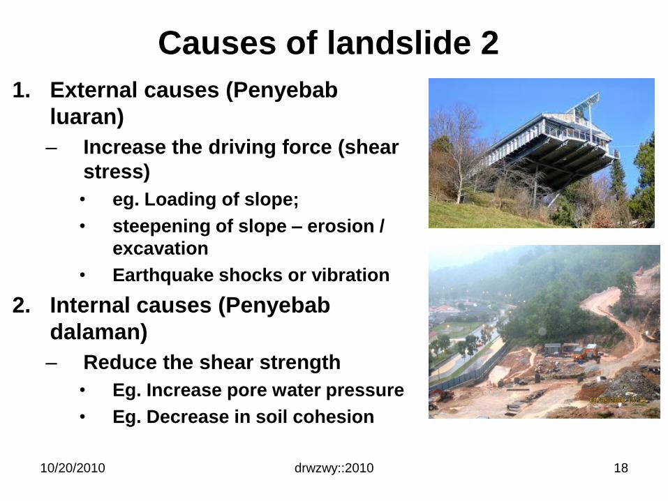
Causes of landslide 2
1. External causes (Penyebab
luaran)
– Increase the driving force (shear
stress)
• eg. Loading of slope;
• steepening of slope – erosion /
excavation
• Earthquake shocks or vibration
2. Internal causes (Penyebab
dalaman)
– Reduce the shear strength
• Eg. Increase pore water pressure
• Eg. Decrease in soil cohesion
drwzwy::201010/20/2010 18
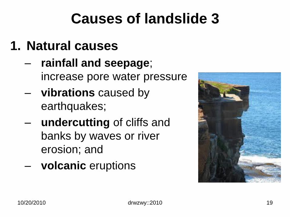
Causes of landslide 3
1. Natural causes
– rainfall and seepage;
increase pore water pressure
– vibrations caused by
earthquakes;
– undercutting of cliffs and
banks by waves or river
erosion; and
– volcanic eruptions
drwzwy::201010/20/2010 19
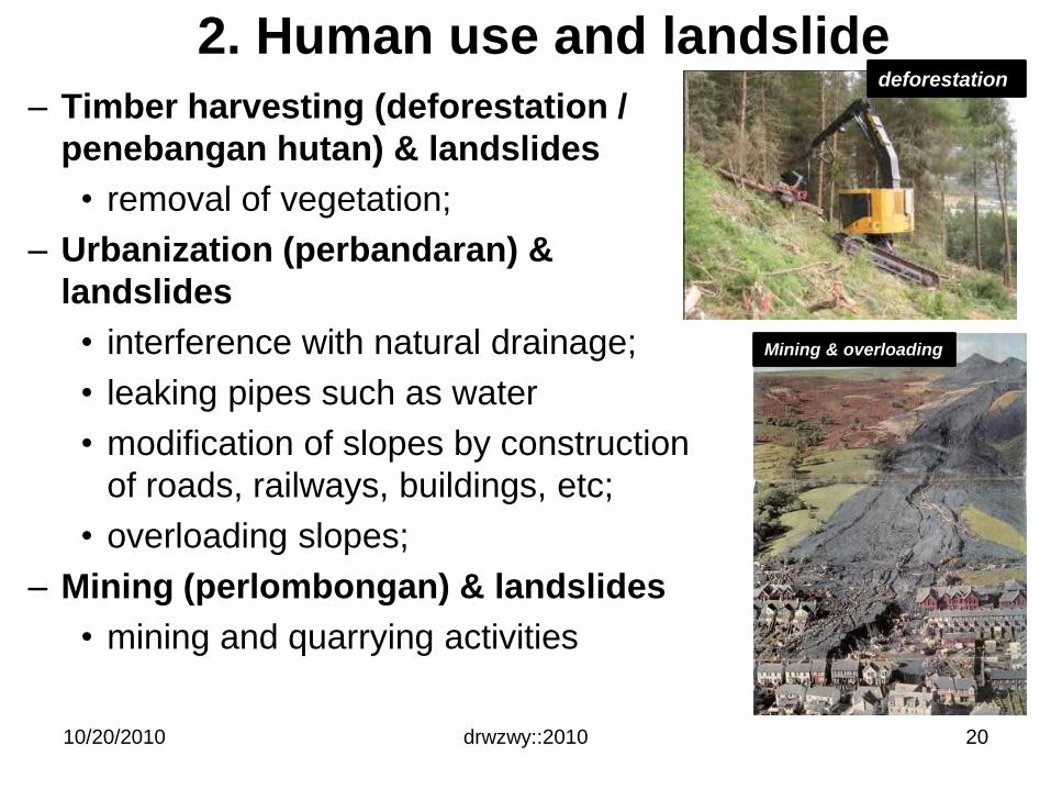
2. Human use and landslide
– Timber harvesting (deforestation /
penebangan hutan) & landslides
• removal of vegetation;
– Urbanization (perbandaran) &
landslides
• interference with natural drainage;
• leaking pipes such as water
• modification of slopes by construction
of roads, railways, buildings, etc;
• overloading slopes;
– Mining (perlombongan) & landslides
• mining and quarrying activities
drwzwy::201010/20/2010 20
Mining & overloading
deforestation
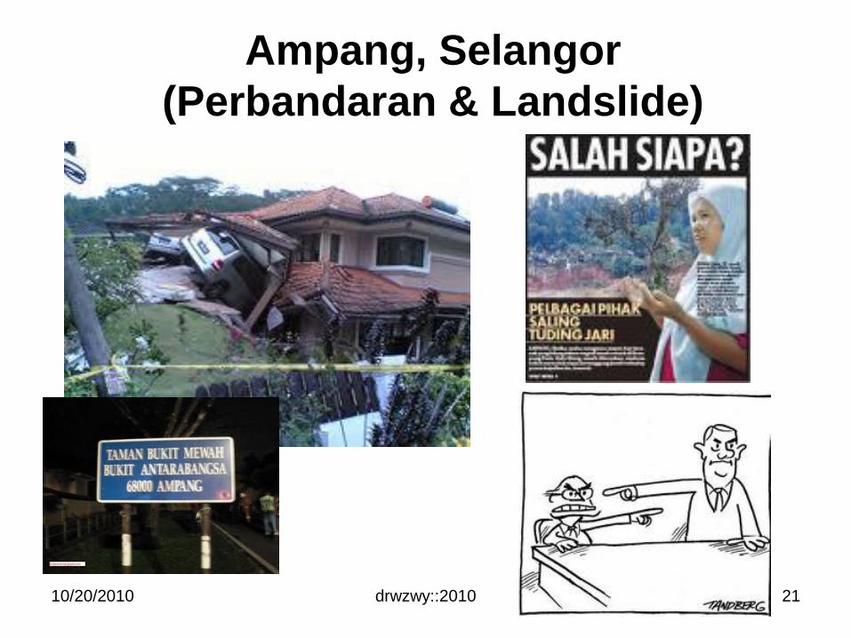
Ampang, Selangor
(Perbandaran & Landslide)
drwzwy::201010/20/2010 21
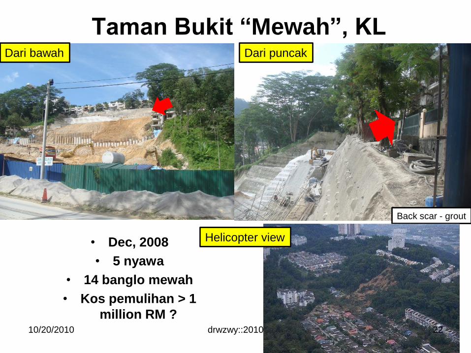
Taman Bukit “Mewah”, KL
• Dec, 2008
• 5 nyawa
• 14 banglo mewah
• Kos pemulihan > 1
million RM ?10/20/2010 drwzwy::2010
Dari bawah
Back scar - grout
Dari puncak
Helicopter view
22
drwzwy::2010
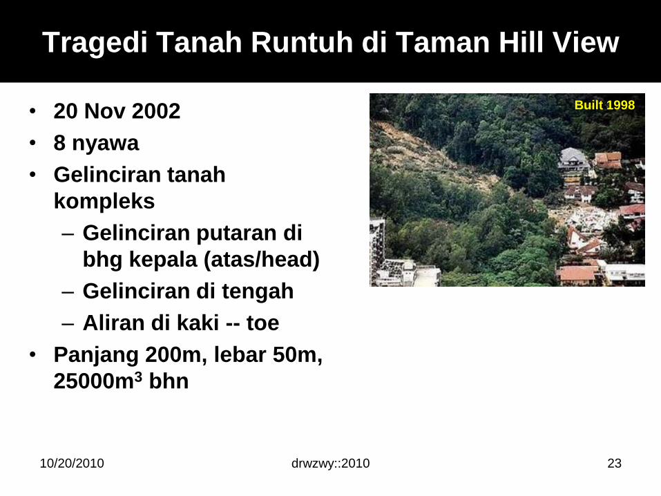
Tragedi Tanah Runtuh di Taman Hill View
• 20 Nov 2002
• 8 nyawa
• Gelinciran tanah
kompleks
– Gelinciran putaran di
bhg kepala (atas/head)
– Gelinciran di tengah
– Aliran di kaki -- toe
• Panjang 200m, lebar 50m,
25000m3 bhn
10/20/2010 23
Built 1998
drwzwy::2010
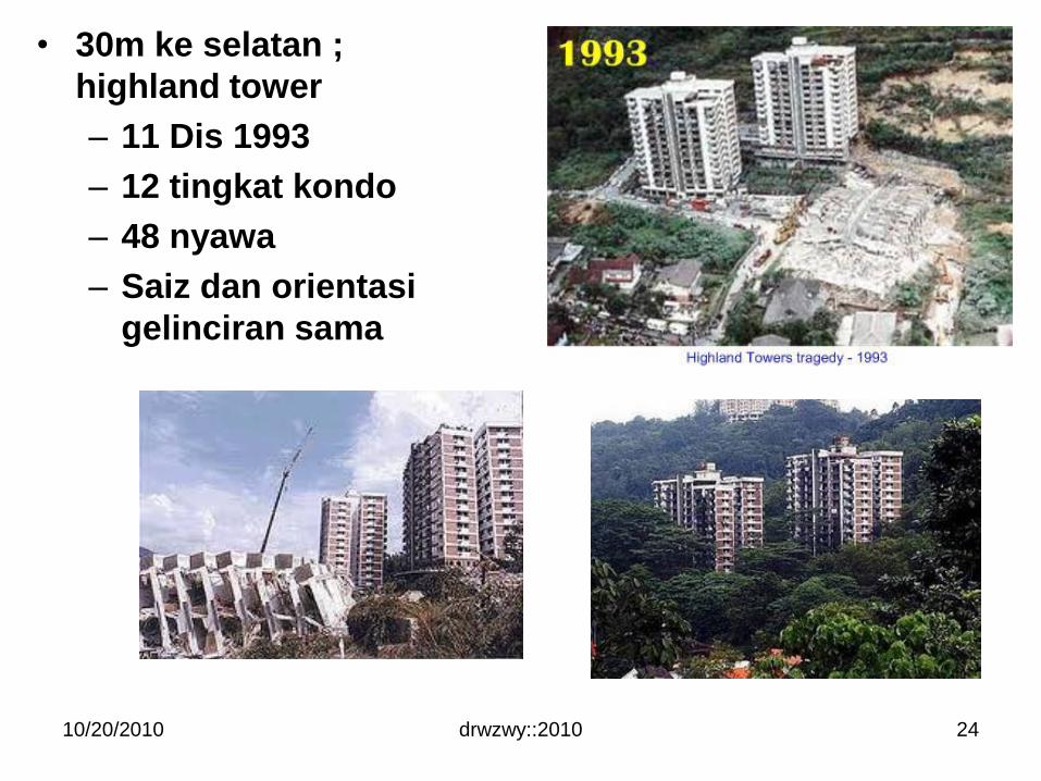
• 30m ke selatan ;
highland tower
– 11 Dis 1993
– 12 tingkat kondo
– 48 nyawa
– Saiz dan orientasi
gelinciran sama
10/20/2010 24
drwzwy::2010
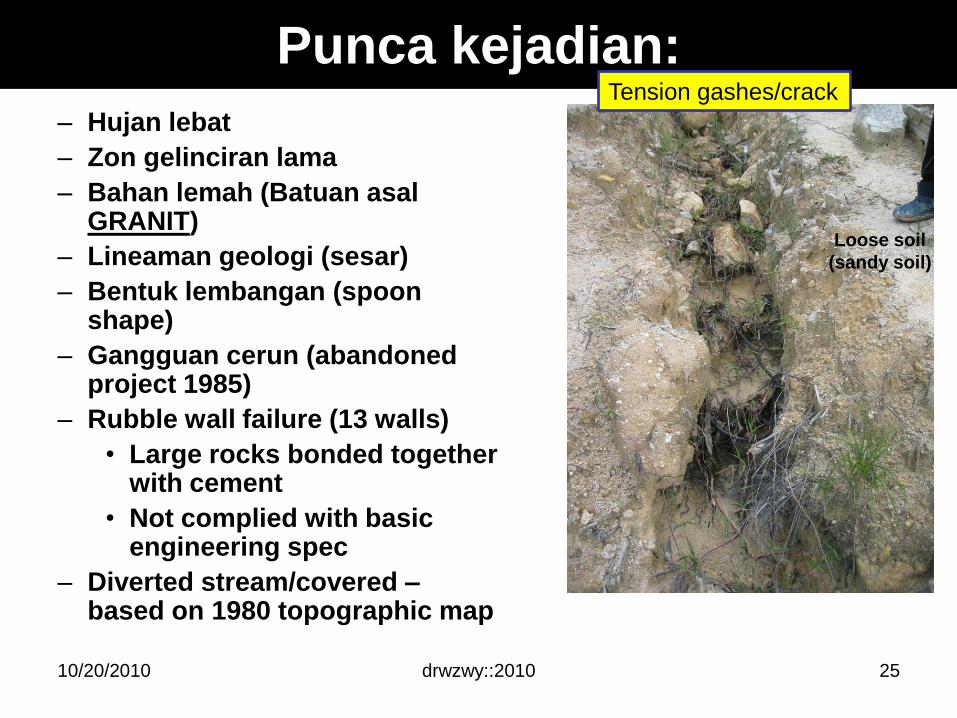
Punca kejadian:
– Hujan lebat
– Zon gelinciran lama
– Bahan lemah (Batuan asalGRANIT)
– Lineaman geologi (sesar)
– Bentuk lembangan (spoon shape)
– Gangguan cerun (abandoned project 1985)
– Rubble wall failure (13 walls)
• Large rocks bonded together with cement
• Not complied with basic engineering spec
– Diverted stream/covered –based on 1980 topographic map
10/20/2010 25
Loose soil
(sandy soil)
Tension gashes/crack
Vaiont Dam, Italy
drwzwy::201010/20/2010 26
drwzwy::2010
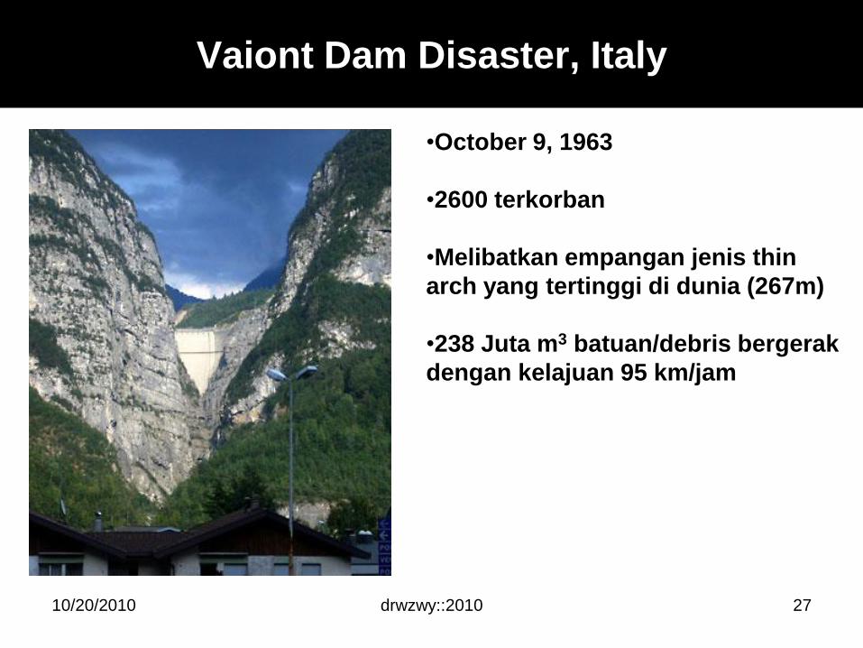
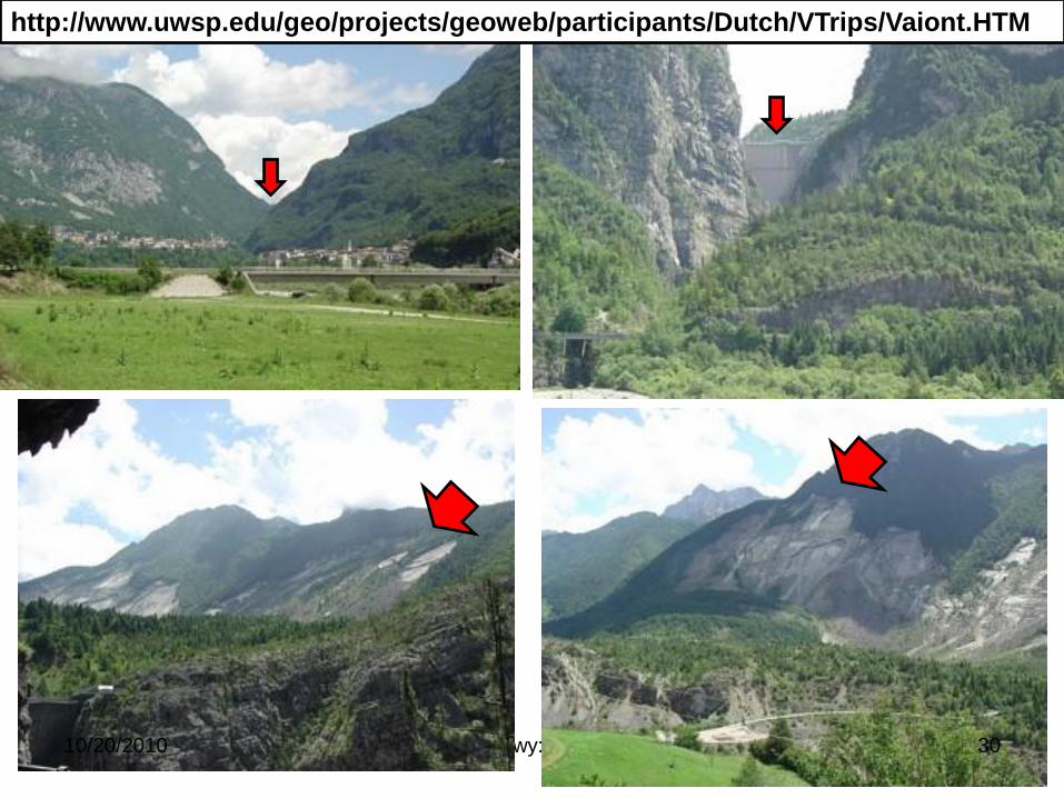
Vaiont Dam Disaster, Italy
•October 9, 1963
•2600 terkorban
•Melibatkan empangan jenis thin
arch yang tertinggi di dunia (267m)
•238 Juta m3 batuan/debris bergerak
dengan kelajuan 95 km/jam
10/20/2010 27
drwzwy::2010
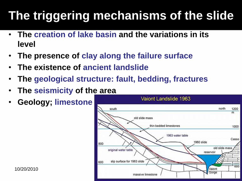
The triggering mechanisms of the slide
• The creation of lake basin and the variations in its
level
• The presence of clay along the failure surface
• The existence of ancient landslide
• The geological structure: fault, bedding, fractures
• The seismicity of the area
• Geology; limestone
10/20/2010 28
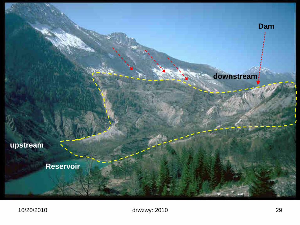
drwzwy::2010
Dam
Reservoir
upstream
downstream
10/20/2010 29
drwzwy::2010
http://www.uwsp.edu/geo/projects/geoweb/participants/Dutch/VTrips/Vaiont.HTM
10/20/2010 30
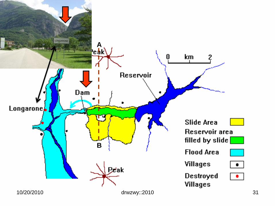
drwzwy::2010
A
B
10/20/2010 31

drwzwy::2010
a) Before ancient landslide
b) Movement down valley
c) New river channel
10/20/2010 32
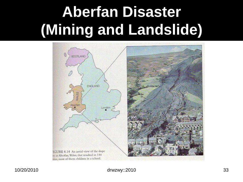
Aberfan Disaster
(Mining and Landslide)
drwzwy::201010/20/2010 33
drwzwy::2010
The Aberfan Disaster
• 9:15am Friday October 21 1966
• Mining village of Aberfan, Merthyr Tydfil, South Wales, UK.
• Runtuhan sisa arang batu
• Runtuhan memusnahkan sebuah sekolah + 20 rumah:– Pantglas Junior School (age 7 to 10)
– “All things bright and beautiful“
– 144 maut: 116 adalah kanak-kanak (i.e. separuhkanak-kanak sekolah)
10/20/2010 34
drwzwy::2010
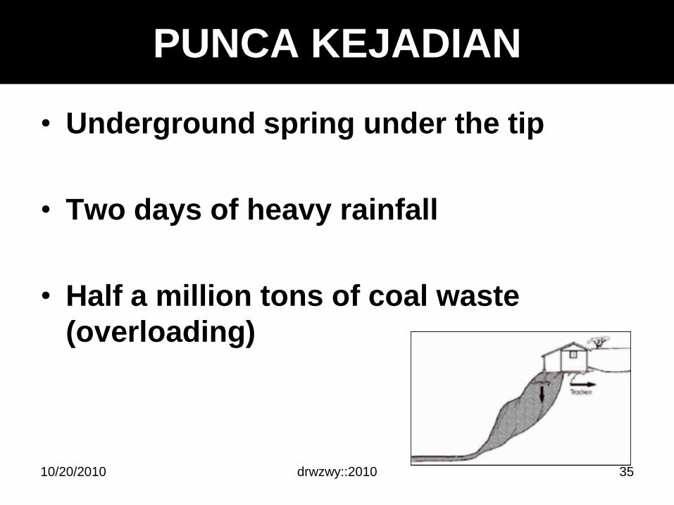
PUNCA KEJADIAN
• Underground spring under the tip
• Two days of heavy rainfall
• Half a million tons of coal waste
(overloading)
10/20/2010 35
drwzwy::2010
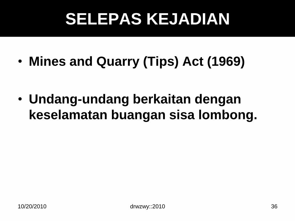
SELEPAS KEJADIAN
• Mines and Quarry (Tips) Act (1969)
• Undang-undang berkaitan dengan
keselamatan buangan sisa lombong.
10/20/2010 36
drwzwy::2010
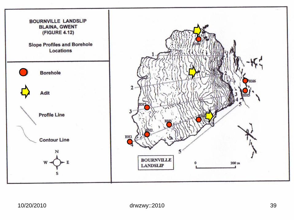
Bournville Landslide, Wales,
United Kingdom
10/20/2010 37
drwzwy::201010/20/2010
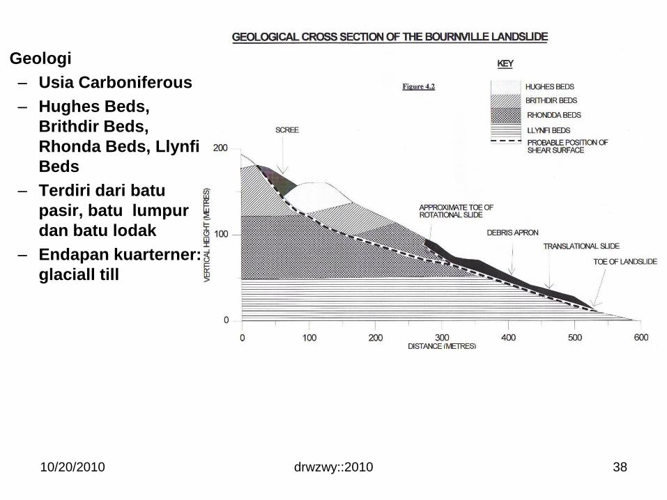
Geologi
– Usia Carboniferous
– Hughes Beds,
Brithdir Beds,
Rhonda Beds, Llynfi
Beds
– Terdiri dari batu
pasir, batu lumpur
dan batu lodak
– Endapan kuarterner:
glaciall till
38
drwzwy::201010/20/2010 39
drwzwy::2010
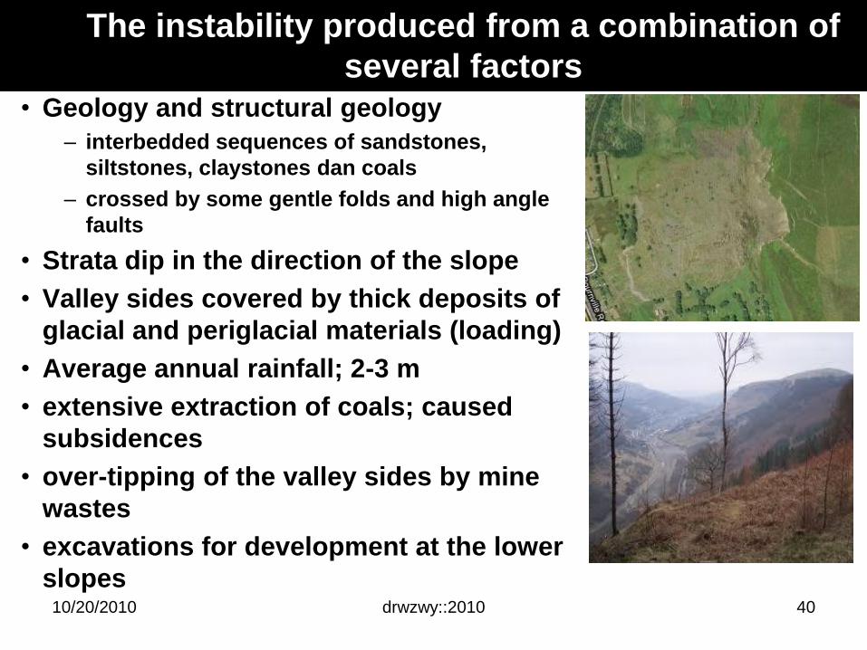
• Geology and structural geology
– interbedded sequences of sandstones,
siltstones, claystones dan coals
– crossed by some gentle folds and high angle
faults
• Strata dip in the direction of the slope
• Valley sides covered by thick deposits of
glacial and periglacial materials (loading)
• Average annual rainfall; 2-3 m
• extensive extraction of coals; caused
subsidences
• over-tipping of the valley sides by mine
wastes
• excavations for development at the lower
slopes10/20/2010
The instability produced from a combination of
several factors
40
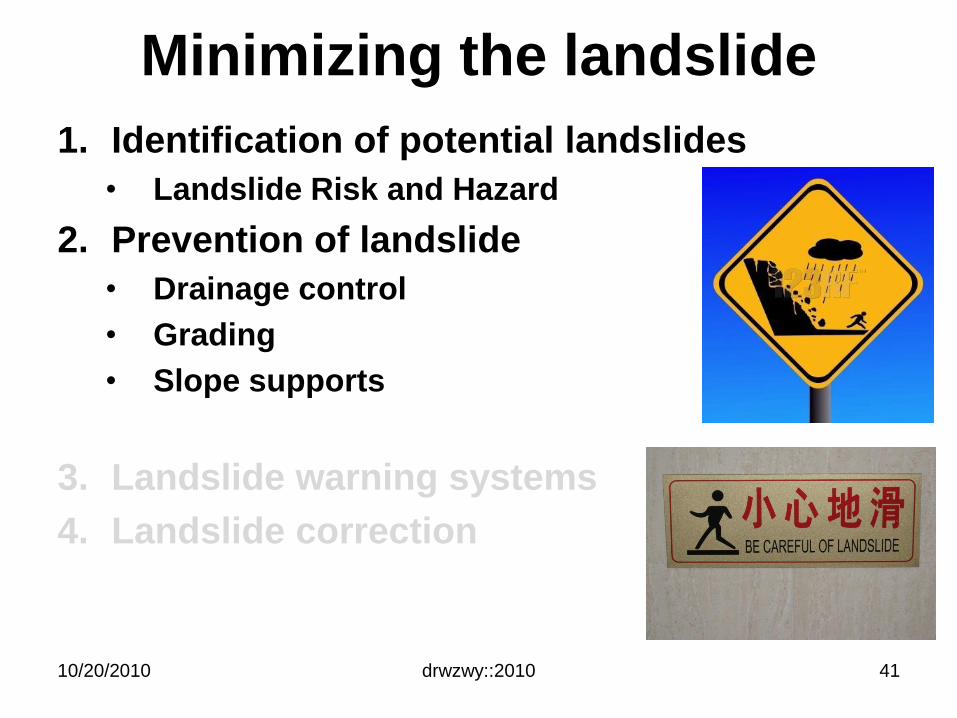
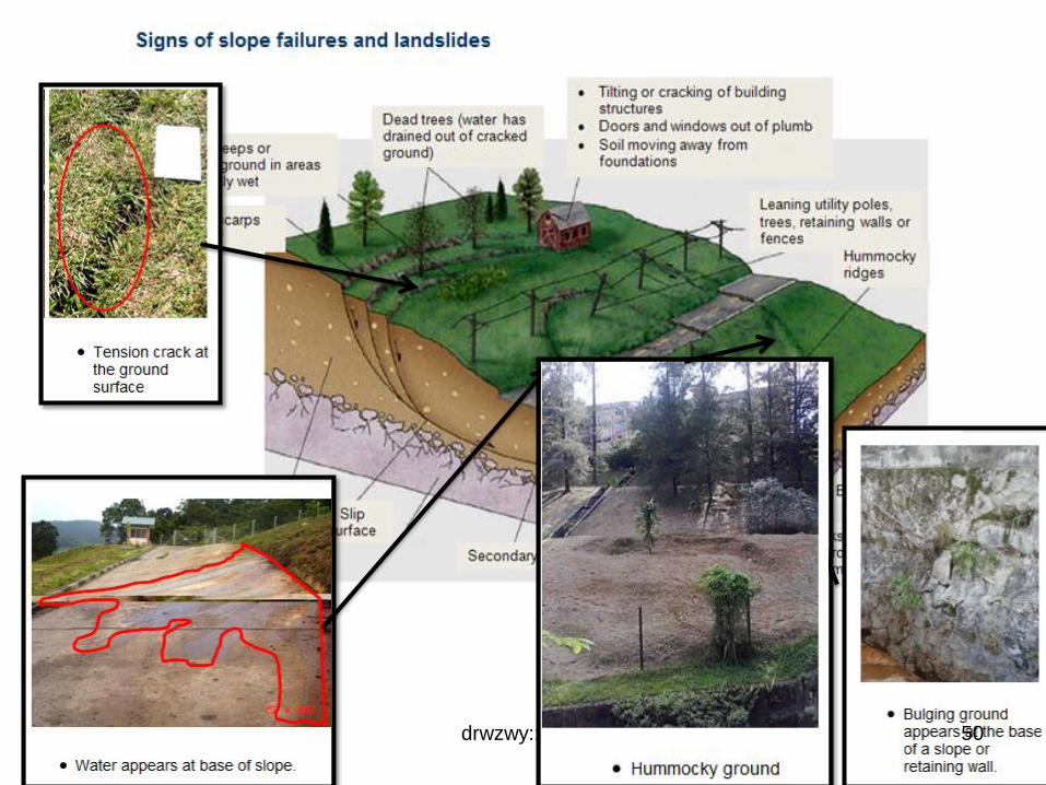
Minimizing the landslide
1. Identification of potential landslides
• Landslide Risk and Hazard
2. Prevention of landslide
• Drainage control
• Grading
• Slope supports
3. Landslide warning systems
4. Landslide correction
drwzwy::201010/20/2010 41
Ris
k a
naly
sis
Ris
k A
ss
es
sm
en
t
Ris
k M
an
ag
em
en
t
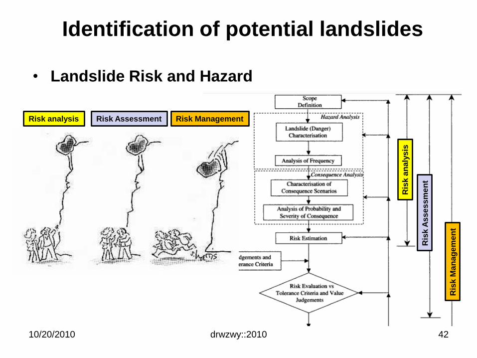
Identification of potential landslides
• Landslide Risk and Hazard
10/20/2010 drwzwy::2010
Risk analysis
42
Risk Assessment Risk Management
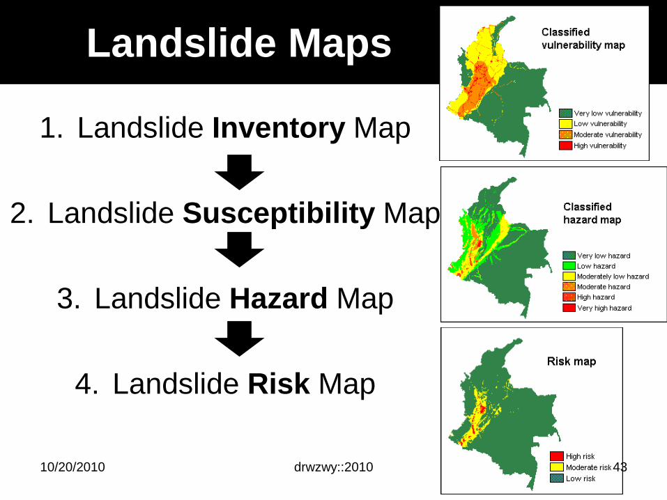
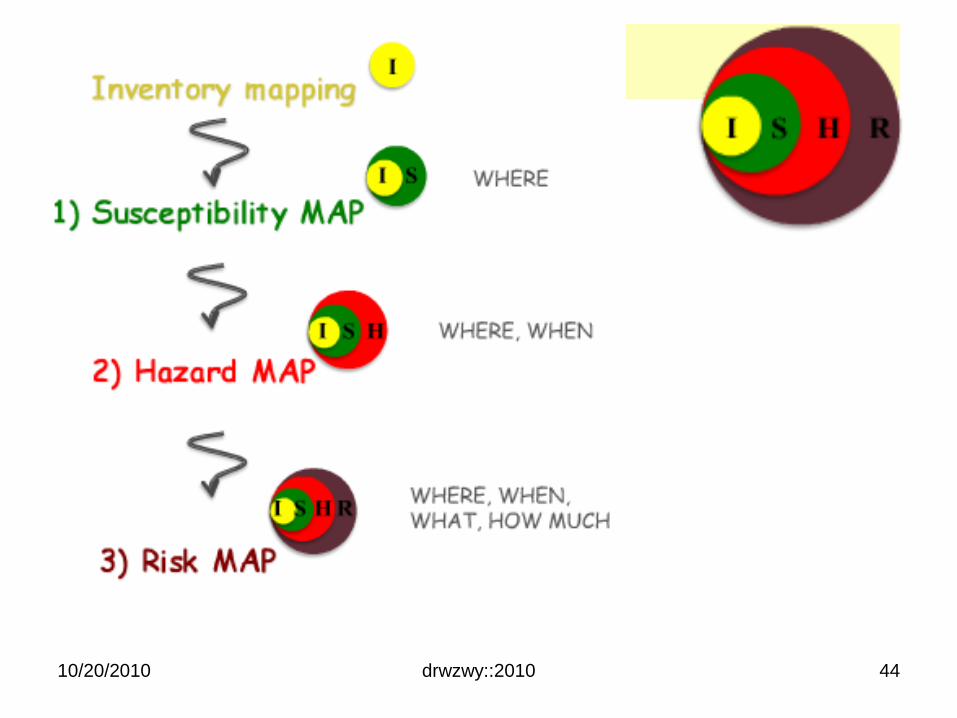
Landslide Maps
1. Landslide Inventory Map
2. Landslide Susceptibility Map
3. Landslide Hazard Map
4. Landslide Risk Map
10/20/2010 drwzwy::2010 43
10/20/2010 drwzwy::2010 44
10/20/2010 drwzwy::2010 45
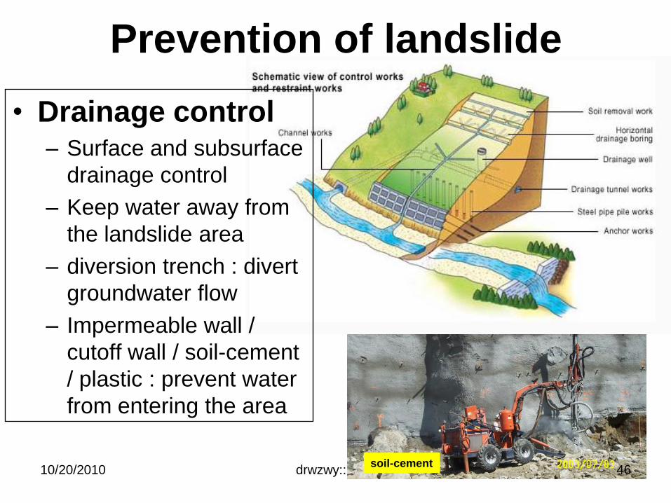
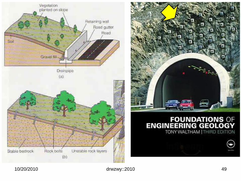
Prevention of landslide
10/20/2010 drwzwy::2010 46
• Drainage control– Surface and subsurface
drainage control
– Keep water away from
the landslide area
– diversion trench : divert
groundwater flow
– Impermeable wall /
cutoff wall / soil-cement
/ plastic : prevent water
from entering the area
soil-cement
Prevention of landslide
10/20/2010 drwzwy::2010
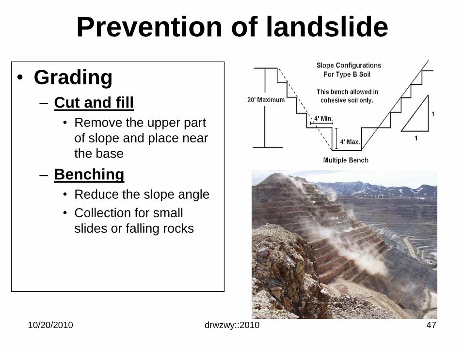
• Grading– Cut and fill
• Remove the upper part
of slope and place near
the base
– Benching
• Reduce the slope angle
• Collection for small
slides or falling rocks
47
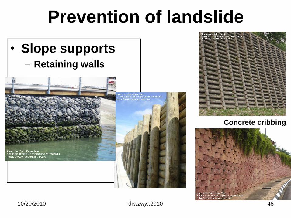
Prevention of landslide
10/20/2010 drwzwy::2010
• Slope supports– Retaining walls
Concrete cribbing
48
drwzwy::201010/20/2010 49
10/20/2010 drwzwy::2010 50
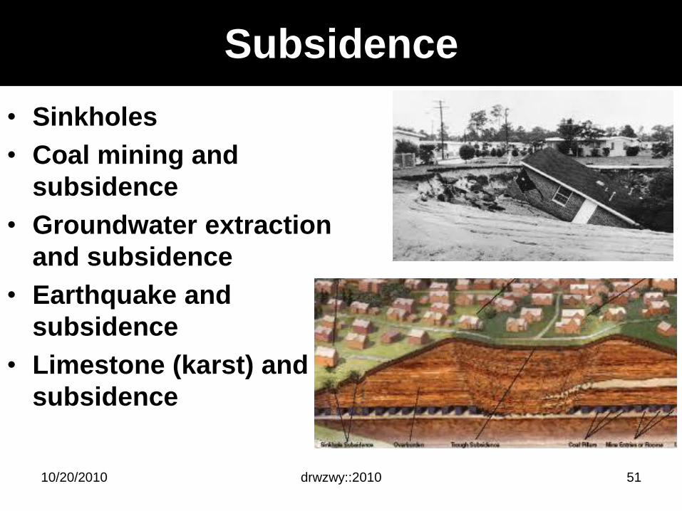
Subsidence
• Sinkholes
• Coal mining and
subsidence
• Groundwater extraction
and subsidence
• Earthquake and
subsidence
• Limestone (karst) and
subsidence
drwzwy::201010/20/2010 51
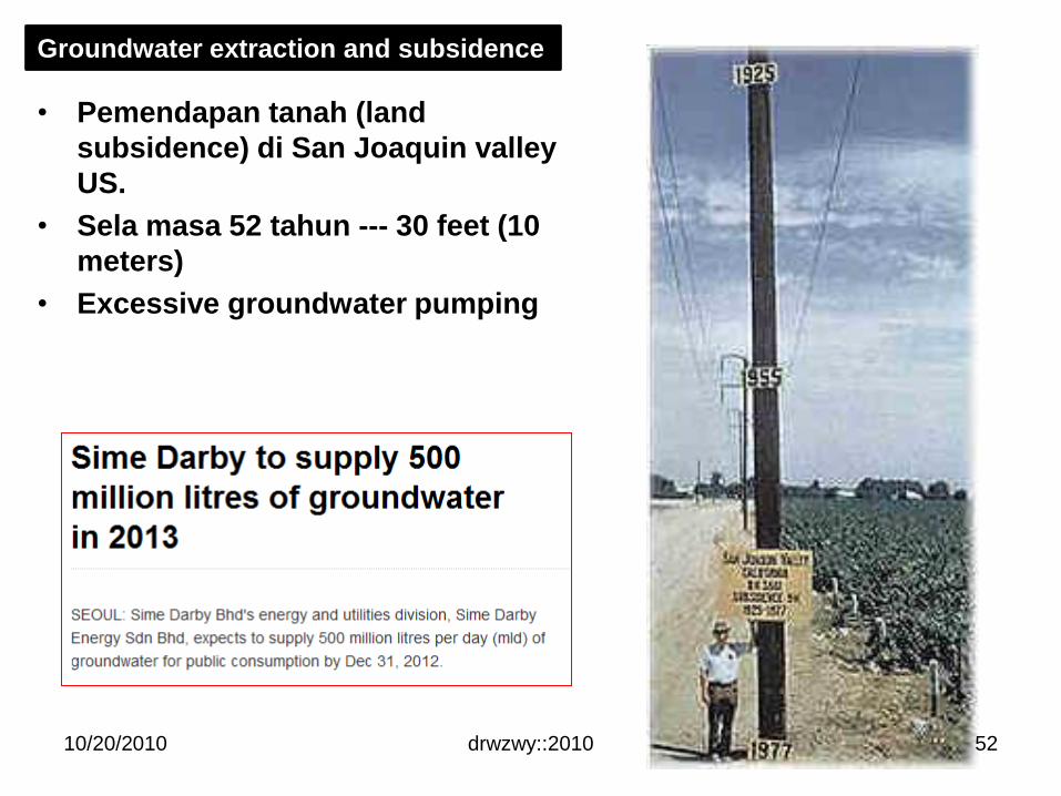
• Pemendapan tanah (land
subsidence) di San Joaquin valley
US.
• Sela masa 52 tahun --- 30 feet (10
meters)
• Excessive groundwater pumping
Groundwater extraction and subsidence
10/20/2010 drwzwy::2010 52
10/20/2010 drwzwy::2010
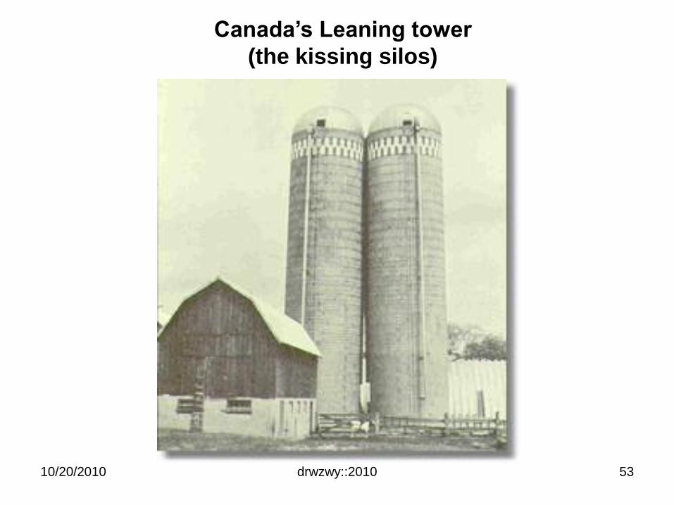
Canada’s Leaning tower
(the kissing silos)
53
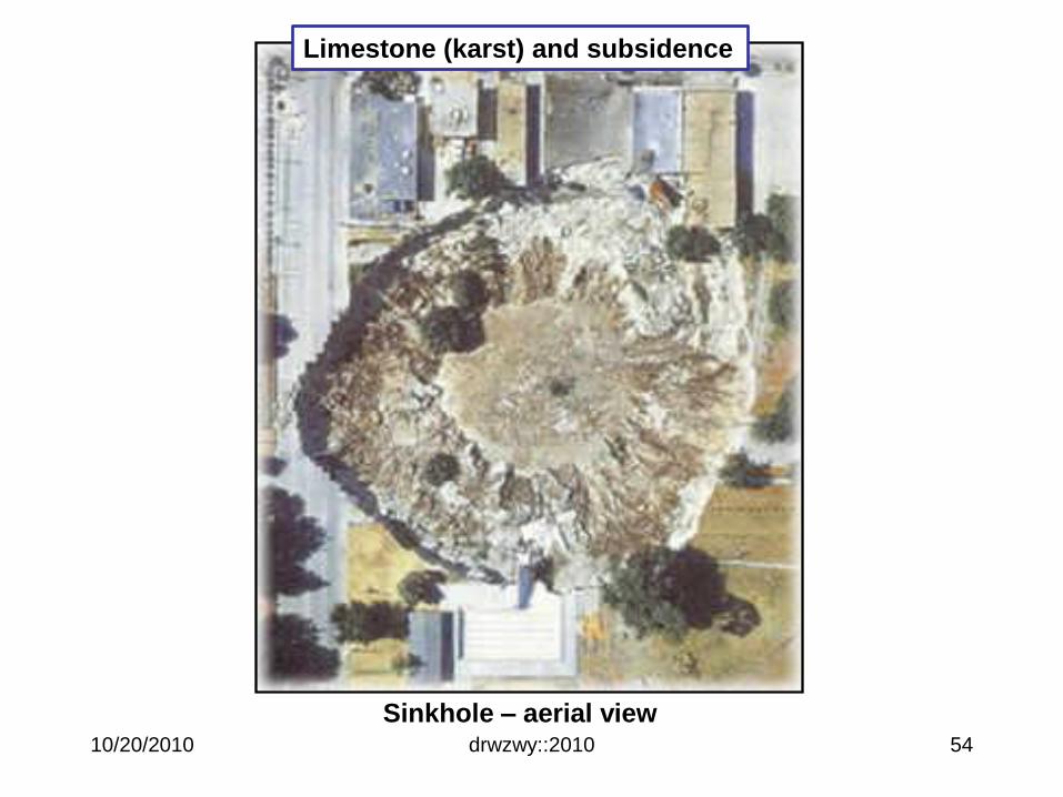
Sinkhole – aerial view
Limestone (karst) and subsidence
10/20/2010 drwzwy::2010 54
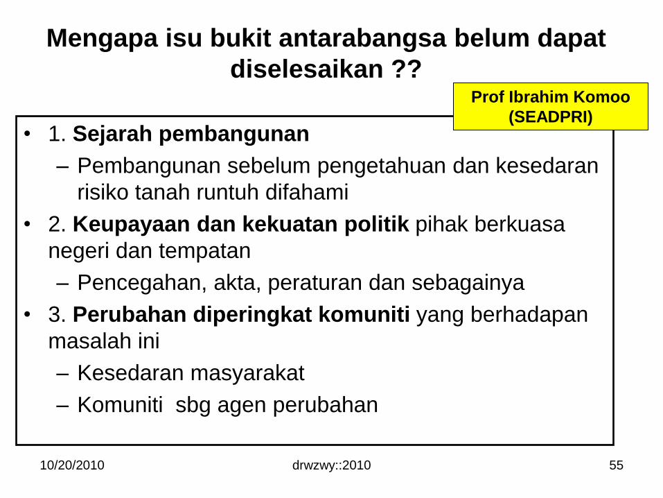
Mengapa isu bukit antarabangsa belum dapat
diselesaikan ??
• 1. Sejarah pembangunan
– Pembangunan sebelum pengetahuan dan kesedaran
risiko tanah runtuh difahami
• 2. Keupayaan dan kekuatan politik pihak berkuasa
negeri dan tempatan
– Pencegahan, akta, peraturan dan sebagainya
• 3. Perubahan diperingkat komuniti yang berhadapan
masalah ini
– Kesedaran masyarakat
– Komuniti sbg agen perubahan
10/20/2010 drwzwy::2010
Prof Ibrahim Komoo
(SEADPRI)
55
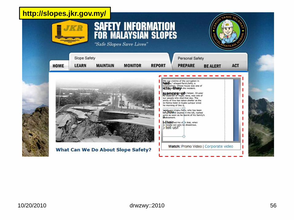
10/20/2010 drwzwy::2010
http://slopes.jkr.gov.my/
56
TAMAT
10/20/2010 drwzwy::2010 57