russel felix koiting thesis submitted in partial ...eprints.ums.edu.my/10735/1/shoreline changes at...
TRANSCRIPT
SHORELINE CHANGES AT MANTANANI BESAR ISLAND, KOTA BELUD, SABAH
MALAYSIA
RUSSEL FELIX KOITING
THESIS SUBMITTED IN PARTIAL FULFILLMENT OF THE REQUIREMENTS FOR
THE DEGREE OF MASTER OF SCIENCE
PERPUSTAKAAN pvvvTRSITI MALAYSIA SABAH
BORNEO MARINE RESEARCH INSTITUTE UNIVERSITI MALAYSIA SABAH
2016

UNIVERSITI MALAYSIA SABAH
BORANG PENGESAHAN STATUS TESIS
Judul: Shoreline Changes at Mantanani Besar Island, Kota Belud, Sabah Malaysia
Ijazah: I3AZAH SAWANA
Saya Russel Felix Koiting, sesi pengajian 2013-2016; mengaku membenarkan tesis sarjana ini disimpan di Perpustakaan Universiti Malaysia Sabah dengan syarat- syarat seperti berikut: -
1. Tesis ini adalah hak milik Universiti Malaysia Sabah 2. Perpustakaan Universiti Malaysia Sabah dibenarkan membuat salinan untuk
pengajian sahaja 3. Perpustakaan dibenarkan membuat salinan tesis ini sebagai bahan pertukaran
antara institusi pengajian tinggi 4. Sila tanda(/):
SULIT (Mengandungi makiumat yang berdarjah keselamatan atau kepentingan Malaysia seperti yang termaktub di dalam AKTA RAHSIA 1972)
TERHAD (Mengandungi makiumat TERHAD yang telah ditentukan oleh organisasi/badan di mana penyelidikan dijalankan)
TIDAK TERHAD
Disahkan oleh, 'JURULAIN BINTI ISMAIL
ýRQLIAN AYSIA SARAH
Felix Koiting Tandatangan Pustakawan
Tarikh: 9 September 2016

DECLARATION
I hereby declare that the material in this thesis is my own except for quotations, equations, summaries and references which have been duly acknowledged.
18 August 2016 Russel Felix Koiting
MY1221005T
11
CONFIRMATION
NAME : RUSSEL FELIX KOITING
MATRIK NO. : MY1221005T
TITLE : SHORELINE CHANGES AT MANTANANI BESAR ISLAND, KOTA BELUD, SABAH MALAYSIA
DEGREE : MASTER OF SCIENCE (MARINE SCIENCE)
VIVA DATE : 20 JULY 2016
CERTIFIED BY;
1. SUPERVISOR Associate Professor Dr. Ejria Saleh Signa Zre
2. CO-SUPERVISOR Dr. John Madin
III
ACKNOWLEDGEMENTS
This research could never be accomplished without the guidance, support and help of many people. Here, I would like to thanks all the people who have assisted me in doing this research.
First of all, I would like to show my utmost gratitude to my supervisor, Associate Professor Dr. Ejria Saleh and my co-supervisor, Dr. John Madin, for their guidance, comments and suggestions in this study. They patiently guided me through the thesis and the knowledge that has been shared is very helpful. Their supervision and guidance towards this completed thesis are truly appreciated.
Next, I would like to thanks, Department of Marine Park, Ministry of Natural Resources and Environment, Malaysia for their financial support under grant GL00102. I also like to thank Malaysian Remote Sensing Agency with the contact person, Ms. Suziyanna Arshad for sending me one satellite image for free which is very helpful. Appreciation is given to Sabah Forest Management, Sabah Lands and Surveys Department and Department of survey and Mapping Malaysia for their supplies on various aerial photographs which are very useful in this study.
Moreover, I would like to thank all my friends for their encouragement and support. Special thanks to Mr. Mustapha Abdul Talip (CerGIS UMS), Mr. Dunstan Anthony (NAHRIM) and Mdm. Fazliana Mustajap for their assisting on the usage and understanding of ArcGIS Software. They have taught me a lot about the software and the techniques in data analysis. Appreciations are also given to Borneo Marine Research Institute (BMRI) boatman and laboratory assistants for providing the equipment needed and the assistance from undergraduate students (UMS) and practical students for their help and accompanying throughout the sampling at Mantanani Besar Island shoreline area.
Last but not least, I would like to show my gratitude to my parents and family for their tremendous support. They have given me continuous encouragement, advice, understanding and their nonstop moral supports.
Thank you.
Russel Felix Koiting 18 August 2016
iv
ABSTRACT
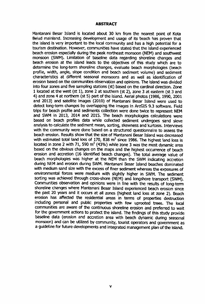
Mantanani Besar Island is located about 30 km from the nearest point of Kota Belud mainland. Increasing development and usage of its beach has proven that the island is very important to the local community and has a high potential for a tourism destination. However, communities have stated that the island experienced beach erosion especially during the peak northeast monsoon (NEM) and southwest monsoon (SWM). Limitation of baseline data regarding shoreline changes and beach erosion at the island leads to the objectives of this study which are to determine the long-term shoreline changes, evaluate beach morphologies (beach profile, width, angle, slope condition and beach sediment volume) and sediment characteristics at different seasonal monsoons and as well as identification of erosion based on the communities observation and opinions. The island was divided into four zones and five sampling stations (st) based on the cardinal direction. Zone 1 located at the west (st 1), zone 2 at southern (st 2), zone 3 at eastern (st 3 and 4) and zone 4 at northern (st 5) part of the island. Aerial photos (1986,1990,2001 and 2013) and satellite images (2010) of Mantanani Besar Island were used to detect long-term changes by overlapping the images in ArcGIS 9.3 software. Field trips for beach profile and sediments collection were done twice to represent NEM and SWM in 2013,2014 and 2015. The beach morphologies calculations were based on beach profiles data while collected sediment undergoes sand sieve analysis to calculate the sediment mean, sorting, skewness and kurtosis. Interviews with the community were done based on a structured questionnaire to assess the beach erosion. Results show that the size of Mantanani Besar Island was decreased with estimated total land loss of 170,838 m2 since 1986. The highest land loss is located in zone 2 with 71,590 m2 (43%) while zone 3 was the most dynamic area based on the obvious changes on the maps and the highest occurrence of beach erosion and accretion (16 identified beach changes). The total average value of beach morphologies was higher at the NEM than the SWM indicating accretion during NEM and erosion during SWM. Mantanani Besar Island beaches dominated with medium sand size with the excess of finer sediment whereas the exposures of environmental forces were medium with slightly higher in SWM. The sediment sorting was achieved through cross-shore (NEM) and longshore transport (SWM). Communities observation and opinions were in line with the results of long-term shoreline changes where Mantanani Besar Island experienced beach erosion since the past 20 years and it occurs at all zones (highest land loss at zone 2). Beach erosion has affected the residential areas in terms of properties destruction including personal and public properties with few uprooted trees. The local communities are aware of the continuous shoreline erosion and preferred to wait for the government actions to protect the island. The findings of this study provide baseline data (erosion and accretion area with beach dynamic during seasonal monsoon) and can be utilized by community, tourist operators and government as a guideline for future developments and integrated management plan of the island.
V
ABSTRAK
(PERUBAHAN PESISIRAN PANTAI DI PULAU MANTANANI BESAR, KOTA BEL UD, SABAH MA LA YSL4)
Pulau Mantanani Besar terletak kira-kira 30 km dart daerah Kota Belud. Pembangunan dan penggunaan pantai yang semakin pesat membuktikan bahawa pulau ini amatlah penting kepada penduduk dan mempunyai potensi yang tinggi sebagai destenasi pelancongan. Walau bagaimanapun, masyarakat telah menyatakan bahawa pulau ini menghadapi hakisan pantai terutamanya pada puncak monsun timur laut (MTL) dan monsun barat daya (MBD). Data asas yang terhad mengenai perubahan garis pantai dan hakisan pantai di pulau ini telah membawa kepada objektif kajian ini iaitu menentukan perubahan garis pantai janga panjang, mengen/ past! morfologi pantai (profrl pantal, kelebaran, sudut, keadaan cerun dan /s/ padu pantai) dan anggaran c/ri-c/r i mendapan pada monsun yang berbeza dan juga mengnal past! hak/san berdasarkan pemerhatlan dan pendapat masyarakat pulau. Pulau /ni telah dibahagikan kepada empat zon dan //ma stesen (st) persampelan berdasarkan arah angin. Zon 1 terletak dl bar at (st 1), zon 2 di selatan (st 2), zon 3 di timur (st 3 dan 4) dan zon 4 di utara (st 5) pulau tersebut. Foto udara (1986,1990,2001 dan 2013) dan imej satelit (2010) digunakan untuk mengesan perubahan jangka panjang dengan menindihkan imej- imej tersebut da/am perisian ArmGIS 9.3. Kerja lapangan untuk pen/la/an profil pantai dan pengutipan mendapan dilakukan dua kal/ bag/ mewak/l/ kedua-dua monsun pada tahun 2013,2014 dan 2015. Peng/man morfo%g/ pantal yang lain adalah berdasarkan data profrl pantai mankala mendapan yang d/kut/p menjalan/ anal/s/s penapis pas/r untuk mendapatkan mean, sorting, skewness dan kurtosis Temubua/ bersama masyarakat tempatan telah dilakukan menggunakan borang soal selldlk untuk men/la/ hakisan pantai. Keputusan menunjukkan bahawa sa/z Pulau Mantanan/ Besar adalah berkurangan d/ mana jumlah kawasan tanah yang terhak/s dianggarkan 170,838 n? sejak tahun 1986. Hakisan pantai yang teritingg/ terletak d/ zon 2 dengan 71,590 mz (43%) manakala zon 3 merupakan kawasan yang paling d/nam/k berdasarkan perubahan jelas dalam sedap peta dan menerima haklsan dan penambahan panta/ yang paling tinggi (16 perubahan pantai yang d/kenal paste). lumlah purata morfo%g/ pants/ /ebih tingg/ pada MTL daripiada MBD menunjukkan pertambahan panta/ semasa MTL dan hakisan semasa MBD. Pantai di Pulau Mantanan/ Besar mempunya/ purata pas/r yang bersaiz sederhana dengan leb/han mendapan halus manakala pendedahan daya semulajadi adalah sederhana dengan sed/k/t tingg/ pada MBD. Sorting mendapan adalah secara sejajar(MTL) dan selari (MBD). Pemerhat/an dan pendapat masyarakat adalah selaras dengan keputusan perubahan garis pantai jangka panjang di mana Pulau Mantanan/ Besar mengalami hakisan pantal sejak 20 tahun yang lalu dan ianya berlaku pada semua zon (zon 2 menerima hak/san pantai yang tertinggi). Hak/san pantai telah member! kesan pada kawasan perumahan dari segi kemusnahan harta benda peribadi dan awam serta beberapa pokok tumbang. Masyarakat tempatan sedar dengan masalah hakisan pantai yang berterusan /ni dan lebih suka menunggu tindakan kerajaan untuk melindungi pulau itu. Hasil kajian im menyediakan data asas (kawasan hakisan dan pertambahan dengan dinamik pantai semasa monsun bermusim) dan boleh digunakan o%h masyarakat, pengusaha pelancnngan dan kerajaan sebagai gads panduan untuk pembangunan masa depan dan pelan pengurusan bersepadu bag/ pulau inl.
vi
TABLE OF CONTENTS
TITLE
DECLARATION
CONFIRMATION
ACKNOWLEDGEMENT
ABSTRACT
ABSTRAK
TABLE OF CONTENTS
LIST OF TABLES
LIST OF FIGURES
LIST OF SYMBOLS
LIST OF ABBREVIATIONS
LIST OF APPENDIX
CHAPTER 1: INTRODUCTION
1.1 Introduction
1.2 Mantanani Besar Island
1.3 Problem statements 1.4 Objectives
1.5 Significant of study
CHAPTER 2: LITERATURE REVIEW
2.1 Introduction to Mantanani Island
2.2 Shoreline
2.2.1 Shoreline changes 2.2.2 Nature of shoreline changes
2.3 Beach
2.3.1 Beach morphology 2.3.2 Dynamic of beach sediments
Page
i
ii
III
iv
V
vi
VII
XI
XIII
xvi
xvii
xix
1
1
3 4
5
5
7
7
9
10
13
13
15
17
vii
2.4 Meteomarine factors
2.4.1 Wind
2.4.2 Waves
2.4.3 Water current 2.4.4 Variations of sea level
2.5 Monsoon 2.5.1 Monsoon formation
2.5.2 Asian monsoon 2.5.3 Monsoon in Southeast Asia 2.5.4 Monsoon in Malaysia
2.6 Remote sensing 2.6.1 Basic terms in remote sensing 2.6.2 Aerial photograph 2.6.3 Satellite image
20
20
20 21
22
23
24 24
24
25
26
28
29
31
CHAPTER 3: METHODOLOGY 33 3.1 Study area 33 3.2 Sampling design 35 3.3 Long-term shoreline changes 37
3.3.1 Method and measurement 37 3.3.2 Data analysis 38
3.4 Short-term beach changes 41 3.4.1 Method and measurement 41 3.4.2 Data analysis 43
3.5 Shoreline changes based on local community observation and experience 46
CHAPTER 4: RESULT 48 4.1 Long-term shoreline changes 48
4.1.1 Beach changes between 1986 and 1990 50 4.1.2 Beach changes between 1990 and 2001 51 4.1.3 Beach changes between 2001 and 2010 52 4.1.4 Beach changes between 2010 and 2013 54 4.1.5 Coverage of changes at identified area 55
viii
4.1.6 Changes within the zones 55
4.2 Short-term shoreline changes 56
4.2.1 Beach profile of Mantanani Besar Island 56
4.2.2 Beach width, angle, slope and volume 59
4.2.3 Correlation between beach morphologies (angle versus 61
width, volume versus angle and width versus volume)
4.2.4 Sediment characteristics 61
4.3 Shoreline changes based on local community observation and 64
experience 4.3.1 Respondent information and knowledge on Mantanani 64
Besar Island weather 4.3.2 Shoreline changes based on local community information 65
4.3.3 Shoreline changes Factors with the effects and actions on 66
local community
CHAPTER 5: DISCUSSION
5.1 Beach erosion 5.1.1 Natural processes 5.1.2 Anthropogenic factors
5.2 Changes based on zoning 5.3 Features of Mantanani Besar Island
5.3.1 Sandy spit 5.3.2 Coastal cliff
5.4 Beach morphologies 5.5 Sediment characteristics 5.6 Net longshore drifts along Mantanani Besar Island
5.7 Field observation 5.8 Coastal protection structures 5.9 Limitations of study
CHAPTER 6: CONCLUSION
6.1 Conclusion
6.2 Recommendation
69
69
70
72
73 74
75
77
77
78
80
82
86
89
90
90
92
ix
REFERENCES 93
APPENDIX 107
X
LIST OF TABLES
Table 2.1: Shoreline categories in Malaysia
Table 2.2: Coastal erosion (by category) in Malaysia
Page
11
12
Table 3.1: List of datasets for long-term shoreline changes 37
assessment
Table 3.2: Seasons and interval months for each sampling date 41
Table 3.3: Latitude and longitude of each sampling station 42
Table 4.1: Area of Mantanani Besar Island in different years 49
Table 4.2: Changes in island area and rate of changes for selected 49 time difference
Table 4.3: Erosion and accretion values between 1986 and 1990 51
Table 4.4: Erosion and accretion values between 1990 and 2001 52
Table 4.5: - Erosion and accretion values between 2001 and 2010 53
Table 4.6: Erosion and accretion values between 2010 and 2013 55
Table 4.7: Coverage of area loss and gain at images 55
Table 4.8: Percentage of total beach changes in each zone 56
Table 4.9: The average of beach width, angle, slope condition and 60
sediment volume in each sampling stations
XI
Table 4.10: Coefficients of correlation (r) between beach morphologies 61
Table 4.11: Sediment characteristics for NEM and SWM 63
Table 4.12: General knowledge on Mantanani Island weather 65
Table 4.13: Percentage of respondent observations and opinions on 66
past shoreline erosion
XII
LIST OF FIGURES
Page
Figure 2.1: Key environmental features in Mantanani Island. 8
Figure 2.2: Sketch of beach with common terms. 10
Figure 2.3: Sketch of typical beach morphology. 17
Figure 2.4: Sediment sorting of a) well sorted and b) poorly sorted. 19
Figure 2.5: Inclusive graphic of a) skewness and b) sorting. 19
Figure 2.6: Monsoons domains across the globe. (a: North American, b: 23 South American, c: North American, d: South Africa, e: Asia
and f: Australia-Indonesia).
Figure 2.7: Region of Southeast Asia. 25
Figure 2.8: Energy emission and sensor by a) passive sensor and b) 28
active sensor.
Figure 2.9: Aerial photograph was taken in a) vertical and b) oblique 31
angle.
Figure 2.10: Summary for processing image satellite, a) energy sources, 32 b) radiation, c) interaction with the target, d) energy recorded by the sensor, e) transmission, reception and processing, f) interpretation and analysis and g) application.
Figure 3.1: Mantanani Besar Island and location of sampling stations. 34 (St: Station, KSB: Kg. Siring Bukit, KP: Kg. Padang)
XIII
Figure 3.2: Sampling design for shoreline changes assessments at 36
Mantanani Besar Island shoreline.
Figure 3.3: Location of shoreline zoning in Mantanani Besar Island. 40
Figure 4.1: Comparison of Mantanani Besar Island shoreline in different 48
years (1986,1990,2001,2010 and 2013).
Figure 4.2: Locations of erosion and accretion areas between 1986 and 50
1990.
Figure 4.3: Locations of erosion and accretion areas between 1990 and 51
2001.
Figure 4.4: Locations of erosion and accretion areas between 2001 and 53
2010.
Figure 4.5: Locations of erosion and accretion areas between 2010 and 54
2013.
Figure 4.6: Average for SWM and NEM beach profiles at all sampling 58
stations.
Figure 4.7: Respondent information where a) sex, b) age, c) occupation 64
and d) period of staying at the island.
Figure 4.8: Factors of shoreline erosion along the island, a) natural 67
causes and b) anthropogenic causes.
Figure 4.9: Local communities' respond on further erosion in Mantanani 67
Besar Island, a) shoreline erosion affects residents, b)
effects of shoreline erosion, c) local's concern, d) actions
and e) preparations.
XIV
Figure 5.1: Pathway of Tropical Storm GREG. 71
Figure 5.2: Neighboring islands (Mantanani Kecil and Linggisan Island) 74
at western area of Mantanani Besar Island.
Figure 5.3: Spit formation at zone 3 from the year a) 1990 to 2001, b) 76
2001 to 2010 and c) 2010 to 2013.
Figure 5.4: Cave and arches form at lower part of Mantanani Besar 77
Island cliff.
Figure 5.5: Estimated net longshore drifts along Mantanani Besar Island. 81
Figure 5.6: Condition of the coconut tree used to be a benchmark at St. 83 2 in a) 2014 and b) 2015.
Figure 5.7: Condition of Kg. Padang a) jetty and b) house in 2014 and 84 2015.
Figure 5.8: Seawall and zinc were built as part of the beach protections. 85
Figure 5.9: Stranded woods found at zone 1 and zone 2.85
Figure 5.10: Dead corals and rocks were arranged as shoreline 87
revetment.
xv
LIST OF SYMBOLS
°- Degree
0C - Degree Celsius
- Percentage
- Approximately
- Negative/Minus
+- Positive/Add
- Equals to
9- Degree of slope
<- Greater than
>- Less than
>- Greater than or Equal to
0- Ogive
co - Infinity
xvi
LIST OF ABBREVIATIONS
pm - Micrometers
A- Accretion
avg - Average
BMRI - Borneo Marine Research Institute
cm - Centimeters
DHI - Danish Hydraulic Institute
DID - Department of Irrigation and Drainage
E- Erosion
ECD - Environmental Conservation Department
EPD - Environmental Protection Department
EPU - Economic Planning Unit
Eq - Equation
f- Frequency
g- Gram
GCP - Ground Control Points
GIS - Geographic Information System
GPS - Global Positioning System
GRADISTAT - Grain size distribution and statistics IOC - Intergovernmental Oceanographic commission IPCC - Intergovernmental Panel on Climate Change
km - Kilometers
km/h - Kilometers per hour
Kg. - Kampung
KP - Kampung Padang
KSB - Kampung Siring Bukit
m- Meters
MACRES - Malaysian Centre for Remote Sensing
MDE - Maryland Department of the Environment
mm - Millimeters
m2 - Meters square
m2/y - Meters square per year m3/m - Meters cube per meter
xvii
NCES - National Coastal Erosion Study
NEM - Northeast Monsoon
NSRC - National Remote Sensing Committee
PCS - Projected Coordinate System
PGA - Pasukan Gerakan Am (General Operation Force)
R&D - Research and Development
RCM - Reef Check Malaysia
SACREC - Swedish Agency for Research Cooperation
St - Station
SWM - Southwest Monsoon
UNEP - United Nations Environment Programme
WMO - World Meteorological Organization
WCRP - World Climate Research Programme
xviii
LIST OF APPENDIX
Appendix A 21 sizes of sediment in GRADISTAT program
Page
107
Appendix B Illustration of beach profiling technique 108
Appendix C Location of ground control points (GCPs) at the base layer 108
Appendix D Different color polylines used in each map 109
Appendix E Classification of sediment statistical parameters (mean, 110
sorting, skewness and kurtosis)
Appendix F Five sections of the structured questionnaire 111
Appendix G Total areas loss and gain at identified areas 112
Appendix H Beach profiles at all sampling stations 115
Appendix I Summaries for averages beach morphologies 116
Appendix I Scattered graphs for beach morphologies at all stations 117
Appendix K Name list for interviewees 120
Appendix L Ranges of sorting in sandstones and their origin 121
Ax
CHAPTER 1
INTRODUCTION
1.1 Introduction
Shore or shoreline is a boundary that separating the land and water body. Along
the shore, there are beaches which are the extension of land that formed in any
island, country or any landform in the world. Beaches can be found covered with
rocks, sands and vegetation. Rocky beach is a formation and accumulation of rocks
along the shore. The presences of rocks prevent the wave from hitting directly to
the beach sediment and avoid sediment loss. Mangroves are among coastal
vegetation that can tolerate saline water. Such tolerance enables the mangroves to
grow along the beach. The roots of mangroves spread widely and tightly intact to
the beach sediment make it very suitable as a buffer from extreme waves. Sandy
beach is an accumulation of sand along the beach with varies in size ranging from
fine to coarse.
Study of shoreline changes is related to the beach processes. It is the beach
formation (accretion) and destruction (erosion) that happened along the shore. It is
further divided into three parts which are long-term changes, short-term changes
and episodic changes. These changes can provide the pictures on how the
shoreline has changed on a certain period of time and shows the most dynamic
area along the shoreline (Gibeaut, Hepner, Waldinger, Andrews, Gutierrez, Trembley, Smyth and Xu, 2001). Comparison of shoreline can be done by analyzing remote sensing images that have available since the 1930s (aerial photographs). Further improvement of the remotely sensed imagery data has developed the
satellite platforms which provide images that highly consistent and in digital form.
Both aerial photos and satellite images are the best imagery data used in detecting landscape changes over the time (Rocchini and Rita, 2005).
z b
KL N
ý 4 ZE
, __ N OC 1.... y ý a
Studies on long-term shoreline changes are time-consuming and become
apparent only after a significant lapse of a period. Weathering process and human
intervention are the examples of beach processes that take a long period of time.
Cliffs and rocky covered beaches experienced changes or erosion through
weathering while human interventions (planting and cutting down trees) especially
at mangrove covered beaches take years for the growth and mortality of the
plants. Thus shoreline changes at rocky and mangrove beaches are suitable for
long-term changes study. In contrary, short-term changes only happened within
several days or months. It is usually affected the most in sandy beaches.
Movement of sands is very dynamic due to the loose arrangement and the size
variation at the beach. The disturbed sand can be easily moved out or in from the
beach by any factors acting on the sandy covered beach. Shoreline changes at
sandy beaches are suitable to be detected by short-term changes.
Beach morphology constantly change due to the hydrodynamics forces
involving waves, currents, winds and sediments transport that continually interact
with the beach sediments. These two terms (beach morphology and hydrodynamics
forces) are usually studied together as it is the result and the effect of each other (Scott, Masselink and Russell, 2011). Sedimentologists have widely use sediments
size analysis to classify sedimentary environments and elucidate transport dynamics
(Jamil, Norsila and Asraf, 2009). The sediments are able to provide clues to the
sediment provenance, transport history and depositional conditions (Folk and Ward,
1957; Friedman, 1979; Bui, Mazullo and Wilding, 1989; Dora, Kumar, Johnson,
Philip and Vinayaraj, 2012). Results from the sediments size analysis can be related to the hydrodynamics forces at the nearshore area.
Hydrodynamics forces are influenced by the seasonal monsoons where it is
able to change the energy intensity and movement. Throughout a year, a different
energy of waves, currents and winds occurred at different directions depends on the types of the monsoon in one year cycle. Malaysia affected by the northeast monsoon (NEM) and the southwest monsoon (SWM). During NEM (November to March), the coastal currents flow southward bringing heavy rain and rough sea while the currents on SWM (May to September) flows northwards with calmer weather (Nakajima, Yoshida, Bin and Toda, 2015). Effects of monsoons on
2
REFERENCES
Aiello, A. Canora, F. Pasquariello, G. and Spilotro, G. 2013. Shoreline variations and coastal dynamics: A space-time data analysis of the Jonian littoral, Italy. Journal of Estuarine, Coastal and Shelf, 129: 124-135.
Alemayehu, F. Richard, O. Kinyanjui, M. 3. and Oliverv, W. 2014. Assessment of shoreline changes in the period 1969-2010 in Watamuarea, Kenya. Global Journal of Science Frontier Research: (H) Environment and Health Science, 14(6): 18-31.
All, T. A. 2010. Analysis of shoreline changes based on the geometric representation of the shorelines in the GIS data. Journal of Geography and Geospatial Information Science, 1: 1-16.
An, Z. Porter, S. C. Kutzbach, 3. E. Xihao, W. Suming, W. Xaodong, L. Xiaoqiang, L. and Weijian, Z. 2000. Asynchronous Holocene optimum of the East Asian monsoon. Quatemary Science Reviews 19,743-762.
Bahari, A. 2013. Impact of tropical cyclones-Malaysia's experience. 2013 APEC Typhoon Symposium. NTU GIS Convention Center, Taipei, 21-23 October.
Baruah, J. Kotoky, P. and Sarma, J. N. 1997. Textural and geochemical study on river sediments: A case study on the ]hanji River, Assam. Journal of Indian Association Sedimentologists, 16: 195-206.
Bates, R. L. and Jackson, J. A. 1980. Glossary of Geology. 2" d edition, pp. 751. American Geological Institute.
Benassai, G. 2006. Introduction to Coastal Dynamics and Shoreline Protection. Ashurst: WIT Press.
Bendixen, M. Clemmensen, L. B. and Kroon, A. 2013. Sandy berm and beach-ridge formation in relation to extreme sea-levels: A Danish example in a micro- tidal environment. Journal of Marine Geology, 344: 53-64.
Berita Harlan. 2013. Taufan Haiyan Yang Terkuat Di Dunia Mula Melanda Flipina, Bawa Kesan Buruk Kepada Negeri Sabah. Retrieve from httn: //berita- harian. net/berita/taufan-haiyan-yang-terkuat-di-dunia-mula-melanda- filipina-bawa-kesan-buruk-keuada-neaeri-sabah/
Blott, S. J. and Pye, K. 2001. GRADISTAT: A grain distribution and statistics package for the analysis of unconsolidated sediments. Journal of Earth Science, Processes and Landforms, 26: 1237-1248.
Billy, J. Robin, N. Hein, C. J. Certain, R. and Fitzgerald, D. 2014. Internal architecture of mixed sand-and-gravel beach ridges: Miquelon-Langlade Barrier, NW Atlantic. Journal of Marine Geology, 357: 53-71.
Bird, E. C. F. 1996. Beach Management. West Sussex: John Wiley & Sons Ltd.
93
Bird, E. C. F. 1985. Coastline Changes. New York: John Wiley & Sons Ltd.
Biusing, R and Lin, C. F. 2004. Status of spiny lobster resources in Sabah, Malaysia. ACZAR Tropical Spiny Lobster Ecology Workshop. Oceanographic Institute, Nha Trang Vietnam, 20-21 July.
Boak, E. H. and Turner, I. L 2005. Shoreline definition and detection: A review. Journal of Coastal Research, 214: 688-703.
Boden Kloss, C. 1930. The Birds of Mangalum and Mantanani Islands off the West Coast of British North Borneo. Bulletin of the Raffles Museum 4: 117-123.
Bolduc, F. and Afton, A. D. 2004. Relationship between wintering waterbirds and invertebrates sediments and hydrology of coastal marsh ponds. Journal of Waterbirds, 27: 333-341.
Bosch, J. Foley, C. Lipinski, L. McCarthy, J. McNamara, A. Raphael, A. Yang, A. Baldwin, A. and MDE (Maryland Department of the Environment). 2006. Shore Erosion Control Guidelines: Marsh Creation. Maryland Department of the Environment, Wetlands and Waterway Program.
Briggs, D. 1977. Sources and Method in Geography., Sediments London: Butterworth and co. Ltd.
Brown, L. and Young, K. L. 2006. Assessment of Three Mapping Techniques to Delineate Lakes and Ponds in a Canadian High Arctic Wetland Complex. Journal of Arctic, 59(3): 283-293.
Buckley, B. M. Fletcher, R. Wang, S. Y. S. Zottoli, B. and Pottier, C. 2014. Monsoon extremes and society over the past millennium on mainland Southeast Asia. Quatemary Science Reviews, 95: 1-19.
Bui, E. N. Mazullo, 1. and Wilding, L. P. 1989. Using quartz grain size and shape analysis to distinguish between aeolian and fluvial deposits in the Dallol Bosso of Niger (West Africa). Journal of Earth Surface Processes and Landforms, 14: 157-166.
Burnett, B. N. Meyer, G. A. and McFadden, L. D. 2008. Aspect-related microclimatic influences on slope forms and processes, northeastern Arizona. Journal of Geophysical Research, 113: 1-18. F03002, doi: 10.1029/20073F000789.
Burcharth, H. F. and Hughes, S. A. 2005. Coastal Engineering Manual, Part VI Chapter VI-2 Types and Functions of Coastal Structures Washington DC., US: U. S. Army Corps of Engineers.
Carter, R. W. G. 1988. Coastal Environments, pp. 617. Academic Press.
Chabangbom, A. 2014. Asian monsoon over mainland Southeast Asia in the past 25,000 years Department of Geological Sciences Stockholm University SE- 106 91 Stockholm Sweden. ISBN 978-91-7447-969-0.
94
Chalabi, A. Mohd Lokman, H. Mohd Suffian, I. Karamali, K. Karthigeyan, V. and Masita, M. 2006. Monitoring shoreline change using IKONOS image and aerial photographs: A Case Study of Kuala Terengganu area, Malaysia. Proceeding ofISPRS Mid-term Symposium. Enschede, May.
Chand, P and Acharya, P. 2010. Shoreline change and sea level rise along of Bhitarkanika wildlife sanctuary, Orissa: An analytical approach of remote sensing and statistical techniques. Journal of Geomatics and Geosciences, 1: 436-455.
Gift, P. D. and Plumb, R. A. 2008. The Asian Monsoon: Causes, History and Efects pp. 286. Cambridge University Press.
Cooper, N. J. Leggett, D. ]. and Lowe, J. P. 2000. Beach-Profile measurement, theory an analysis: Practical guidance and applied case studies. Journal of Water and Environmental, 14: 79-88.
Cozannet, G. L. Garcin, M. Yates, M. Idler, D. and Meyssignac, B. 2014. Approaches to evaluate the recent impacts of sea-level rise on shoreline changes. Journal of Earth-Science Reviews, 138: 47-60.
Cracknell, A. P. and Hayes, L. 2007. Intradudion to remote sensing. 3rd edition. USA: CRC Press.
Crespi, M. and Vendictis, L. D. 2009. A procedure for high resolution satellite imagery quality assessment. Open Access Sensors, 9: 3289-3313; doi: 10.3390/s90503289.
Cruz, F. T. Narisma, T. G. Villafuerte II, M. Q. Cheng-Chua, K. U. and Olaguera, L M. 2012. A climatological analysis of the southwest monsoon rainfall in the Philippines. Atmospheric Research 122: 609-616.
D'Alpaos, A. Lanzoni, S. Marani, M. Rinaldo, A. 2010. On the tidal prism-channel area relations. Journal of Geophysical Research, 115: 1-13.
Davis, R. A. Jr. 1992. Deposition/ Systems. 2nd edition. NJ, USA: Prentice-Hall Inc.
Davidson, A. D. Boyer, A. G. Kim, H. Pompa-Mansilla, S. Hamilton, M. J. Costa, D. P. Ceballos, G. and Brown, J. H. 2012. Drivers and hotspots of extinction risk in marine mammals. Proceeding of The Nation/Academy of Sciences of The United States of America, 109(9): 3395-3400.
Dayang, S. M. Weliyadi, A. and Aung, T. 2011. Method to estimate the land loss from sea level rise due to gradual warming in Kota Kinabalu, Sabah. Journal of Borneo Science, 28: 18-28.
DHI (Danish Hydraulic Institute). 2005. Sabah Shoreline Management P/an. Introduction to the SMP and Executive Summary.
DHI (Danish Hydraulic Institute). 2013. Sabah Is/and Management P/an. Volume 2, pp. 5-1 - 5-5. Island Management Strategies.
95
DID (Department of Irrigation and Drainage). 1997. Guidelines on Erosion Control for Development Projects in The Coastal Zone. DID Guidelines 1/97.
DID (Department of Irrigation and Drainage). 2007. Kompendium Data dan Maklumat Asas. Retrieve from http: //redac. eng. usm. my/EAD/EAD511/JPS% 20Compgndium%202007. pdf
Dora, G. U. Kumar, V. S. Johnson, G. Philip, C. S. and Vinayaraj, P. 2012. Short- term observation of beach dynamics using cross-shore profiles and foreshore sediment. Journal of Ocean Coastal Management, 67: 101-112.
Dora, G. U. Kumar, V. S. Philip, C. S. Johnson, G. Vinayaraj, P. and Gowthaman, R. 2011. Textural characteristics of foreshore sediments along Karnataka shoreline, west coast of India. Journal of Sediment Reserve, 26: 364-377.
Dyer, K. R. 1985. Coastal and Estuarine Sediment Dynamics. Institute of Oceanography Science, Tuaton.
ECD (Environmental Conservation Department). 2001. Sabah Structure Plan 2020 Final. Environmental and Conservation Workgroup Technical Report 15 (01).
Eisema, D. 1981. Supply and deposition of suspended matter in the North Sea. Special Publication of the International Association of Sedimentologists, 5: 415-428.
ELtohamy, F. and Hamza. 2009. Effect of Ground Control points Location and Distribution on Geometric Correction Accuracy of Remote Sensing Satellite Images. 1P Intemational Conference on AEROSPACE SCIENCES & AVIATION TECHNOLOGY, AS4T--13. Military Technical College, Kobry Elkobbah, Cairo, Egypt, 26-28 May. ASAT-13-RS06.
EPD (Environmental Protection Department), 2013. Key environmental features found In Mantanani Cluster, Sabah Is/and Management P/an. Volume 2. Island Management Strategies.
EPU (Economic Planning Unit), Malaysia. 1985. National Coastal Erosion Study. Government of Malaysia, Kuala Lumpur.
Fan, F. Mann, M. E. and Ammann, C. M. 2009. Understanding Changes in the Asian Summer Monsoon over the Past Millennium: Insights from a Long-Term Coupled Model Simulation. Journal of Climate, 22: 1736-1748.
Fletcher, C. H. Romine, B. M. Genz, A. S. Baerbee, M. M. Dyer, M. Anderson, T. R. Lim, S. C. Vitousek, S. Bochicchio, C. and Richmond, B. M. 2011. National Assessment of Shoreline Change: Historical Shoreline Change in the Hawaiian Islands, pp. 55. Geological Survey Open File Report 2011-1051.
Folk, R. L. & Ward, W. C. 1957. Brazos River bar: A study in the significance of grain size parameters. Journal of Sedimentary Petrology, 27: 3-26.
96
Folk, R. L. 1974. Petrology of sedimentary rocks, pp. 182. Austin, Texas: Hemphili Publication Company.
French, P. W. 2006. Managed realignment-The developing story of a comparatively new approach to soft engineering. Journal of Estuaries Coastal Shelf Science, 67: 409-423.
Friedman, G. M. 1961. Distinction between dune, beach and river sands from textural characteristics. Journal of Sediment Petrology, 31: 514-529.
Friedman, G. M. 1962. On sorting, sorting coefficients and the log normality of the grain-size distribution of sandstones. The Journal of Geology, 70 (6): 737- 753.
Friedman, G. M. 1979. Address of the retiring President of the International Association of Sedimentologists: Differences in size distributions of populations of particles among sands of various origins. Journal of Sedimentology, 26: 3-32.
Friedman, G. M. Sanders, 1. E. and Kopaska-Merkel, D. C. 1992. Principles of Sedimentary Deposits USA: MacMillan Publisher Company.
Ganesh, B. Naidu, A. G. S. S. Rao, M. J. Karudu, T. K. and Avatharam, P. 2013. Studies on textural characteristics of sediments from Gosthani River Estuary - Bheemunipatnam, A. P., East Coast of India. Journal of Ind. Geophysics Union, 17: 139-151.
Garrison, T. 2010. Oceanography: An Invitation to Marine Science. 7`" edition. Belmont: Brooks/cole cengage learning.
Gedan, K. B. Kirwan, M. L. Wolanski, E. Barbier, E. B. and Silliman, B. R. 2011. The present and future role of coastal wetland vegetation in protecting shorelines: Answering recent challenges to the paradigm. Journal of Climate Change, 106 (1): 7-29.
Gibeaut, J. C. Hepner, T. Waldinger, R. Andrews, J. Gutierrez, R. Trembley, T. A. Smyth, R. and Xu, L. 2001. Ganges in Gulf Shoreline Position, Mustang and North Padre Islands, Texas. A Report of the Texas Coastal Coordination Council Pursuant to National Oceanic and Atmospheric. University of Texas. United States of America.
Gopinath, G. and Seralathan, P. 2005. Rapid erosion of the coast of Sagar Island, West Bengal-India. Journal of Environment Geology, 48: 1058-1067
Govil, S. K. 2004. Platform and sensors. In Madhavan Nair, S. G. Govil, S. K. Roy, P. S. Navalgund, R. R. and Thyagaraja, S. K. (eds). International Course on Remote sensing & GIS Application for ASEAN Countries, pp. 23-30. Dehdarune, India, 24th May-4th June.
97
Goswami, B. N. 2005. South Asian Summer Monsoon: An overview. In Chang, C. P. Wang, B. and Lau, N-C. G. (eds). The Global monsoon system: Research and forecast, pp. 47-71. WMO/TD No. 266, World Meteorological Organization, Switzerland.
Guillen, J. Stive, M. J. F. and Capobianco, M. 1999. Shoreline evolution of the Holland coast on a decadal scale. Journal of Earth Surface Processes and Landfomms, 24: 517-536.
Hanslow, D. 3.2007. Beach erosion trend measurement: A comparison of trend indicator. Journal of Coastal Research, 50: 588-593.
Huffman, G. J. Adler, R. F. Arkin, P. Chang, A. Ferraro, R. Gruber, A. Janowiak, J. McNab, A. Rudolf, B. and Schneider, U. 1997. The global precipitation climatology project (GPCP) combined precipitation dataset. Bulletin of the American Meteorological Society, 78 (1): 5-20.
Hughes, M. K. McDowell, P. F. and Marcus, W. A. 2006. Accuracy assessment of georectified aerial photographs: Implications for measuring lateral channel movement in a GIS. Journal of Geomorphology, 74: 1-16.
IOC-UNEP-WMO-SAREC. 1994. Sea level change and their impacts. IOC Workshop Report No. 96: Planning Workshop on an Integrated Approach to Coastal Erosion. Zanzibar, United Republic of Tanzania, 17-21 January.
IPCC (Intergovernmental Panel on Climate Change). 2007. Climate change 2007. " Impact, Adaptation and Vulnerability, pp. 976. Contribution of working group II to the Fourth Assessment Report of the IPCC. Cambridge University Press.
Isla, F. I. and Bujalesky, G. G. 2000. Cannibalisation of Holocene gravel beach-ridge plains, Northern Tierra del Fuego, Argentina. Journal of Marine Geology, 170: 105-122.
Jacques, F. M. B. Su, T. Huang, Y. 1. Wang, L. and Zhou, Z. K. 2013. A global-scale test formonsoon indices used in palaeoclimatic reconstruction. Journal of Palaeoworld, 22: 93-100.
Jamie, H. M. Ed, B. T. and Ad, J. H. M. R. 2006. Rip current review. Journal of Coastal Engineering, 53: 191-208.
Jamil, T. Norsila, D. and Ashraf, A. 2009. Distribution of Sediment Characteristic in Ki/im River Estuary during the Non-Moonsoon and Monsoon Season. pp 381-387. Retrieve from httl: //www. academia. edu/797941/Distribution of Sediment Characteristics in KilimRiver Estuary during the Non-Monsoon and Monsoon Season
Kamaruzzaman, B. Y. Shazili, N. A. M. and Mohd Lokman. 2002. Particle size distribution in the bottom sediments of the Kemaman River Estuarine System, Terengganu, Malaysia. Pertanika Journal of Tropica/Agriculture and Science, 25(2): 149-155.
98
Kilibarda, Z. and Shilinglaw, C. 2014. A 70 year history of coastal dune migration and beach erosion along the southern shore of Lake Michigan. Journal of Aeolian Research, 17: 263-273
Kocurek, G. and Lancaster, N. 1999. Aeolian system sediment state: Theory and Mojave Desert Kelso dune field example. Journal of Sedimentology, 46: 505-515.
Komar, P. D. 1998. Beach Processes and Sedimentation. 2nd edition. Upper Saddle River New Jersey: Prentice-Hall.
Kooloos, J. G. M. Kraaijeveld, A. R. Langenbach, G. E. J. and Zweers, G. A. 1989. Comparatively mechanics of filter feeding in Anas platyrhynchos, Anas clypeata, and Aythya fuligula (Ayes, Anseriformes). Joumal of Zoomorpho%gy, 108: 269-290
Kripalani, R. H. and Kulkami, A. 2001. Monsoon rainfall variations and teleconnections over South and East Asia. International Journal of Climatology, 21: 603-16.
Kripalani, R. H. and Kulkami, A. 1997. Rainfall variability over Southeast Asia connections with Indian monsoon and ENSO extremes: New perspectives. International Journal of Climatology, 17: 1155-1168.
Kumar, M. 2004. Remote sensing fundamentals. In Madhavan Nair, S. G. Govil, S. K. Roy, P. S. Navalgund, R. R and Thygaraja, S. K. (eds). International Course on Remote Sensing & GIS Application for ASEAN Countries, pp. 1-6. Dehradun, India, 24 May-4 June.
Kumar, G. AL. Ramanathan, and Rajkumar, K. 2010. Textural characteristics of the surface sediments of a Tropical mangrove ecosystem Gulf of Kachchh, Gujarat, India. Journal of Marine Science, 39: 415-422.
Lancaster, N. 2009. Aeolian Features and Processes. In Young, R. Norby, L. (eds). Geological Monitoring: Geological Society of America, pp. 1-25. Boulder, Colorado.
Lancaster, N. Baker, S. Bacon, S. and McCarley-Holder, G. 2015. Owens Lake dune fields: Composition, sources of sand, and transport pathways. Journal of Catena, 134: 41-49.
Larson, M. Kubota, S. and Erikson, L. 2004. Swash-zone sediment transport and foreshore evolution: Field experiments and mathematical modelling. Journal of Marine Geology, 212: 61-79.
Limsakul, A. Limjirakan, S. and Suttamanuswong, B. 2010. Asian Summer Monsoon and its Associated Rainfall Variability in Thailand. Joumai of Environmental Asia, 3: 79-89.
Long Island Sound Study. 2003. Long is/and sound habitat restoration initiative, pp. 5-1 - 5-10. Section 5: Coastal Barriers, Beaches and Dunes.
99
Loo, Y. Y. Billa, L. and Singh, A. 2014. Effect of climate change on seasonal monsoon in Asia and its impact on the variability of monsoon rainfall in Southeast Asia. Journal of Geoscience Frontiers, in press: 1-7
Lopez-Ruiz, A. Ortega-Sanchez, M. Baquerizo, A. and Losada, M. A. 2012. Short and medium-term evolution of shoreline undulations on curvilinear coasts. Journal of Geomorphology, 159-160: 189-200.
Malaysian Meteorological Department (MetMalaysia). 2015. Monsoon.. Retrieve from htto: //www. met. qov. mvlindex. phD? oDtion=com content&task=view&id=69 &Itemid=160&lang=english
Malaysian Nature Society. 2004. BirdLife International: Mantanani Island. Retrieve from http: //www. birdlife. ora/datazone/sitefactsheet. phr)? id=16036
McGlashan, D. 3. Duck, R. W. and Reid, C. T. 2005. Defining the foreshore: Coastal geomorphology and British laws. Journal of Estuarine, Coastal and Shelf, 62: 183- 192.
M-Muslim, A. Foody, G. M. and Atkinson, P. M. 2007. Shoreline mapping from coarse-spatial resolution remote sensing imaginery of Seberang Takir, Malaysia. Journal of Coastal Research, 23: 1399-1408.
Mobile Geographics. 2016. Kota Kinabalu, Malaysia Tidal Chart. Retrieve from http: //tides. mobileggographics. com/locations/3162. html
Mohd Ibrahim, S. M. Mazian, H. and Samsudin, A. 2004. Research strategies for remote sensing development in Malaysia. National Workshop on Research Strategy for Space Development, pp. 1-18. Mines Beach Resort & SPA, Selangor, 23-26 August.
Mohd Lokman, H. Rosnan, Y. and Shahbudin, S. 1995. Beach Erosion Variabiltiy during a Northeast Monsoon: The Kuala Setiu Coastline, Terengganu, Malaysia. Journal of Science and Technology, 3: 337-348
Mojiol, A. R. Sompud, J. Saleh, E and Alip, F. 2013. Preliminary survey of coastal beach vegetation at Mantanani Besar Island. In Madin, J. Saleh, E. Shahima, A. H. Abdul Muntalib, J. Nizam, I. and than, A. A. (eds). Mantanani Island., Marine Scientific Expedition, pp. 11-18. Putrajaya, Malaysia: Department of Marine Park Malaysia: Ministry of Natural Resources and Environment.
Moller, H. S. 2002. Bird Observations: Mantanani Islands, Sabah, Malaysia 2002. (Unpublished). In Zahra Yaacob, Moo-Tan, S. and S. Yorath (eds). Proceedings of the International Conference on In-situ and Ex-situ Biodiversity Conservation in the New Millennium, pp. 67-98. Kota Kinabalu, Sabah, 20-22 June 2000.
Momer, N. A. Tooley, M. and Possnert, G. 2004. New perspective for the future of the Maldives. Journal of Global and Planetary Change, 40: 177-182.
100
MonsoonMaiden. 2006. Tropical Storm GREG (43W), 21-27 Dec 1996. Retrieve from https: //forum. netweather. tv/blogs/entry/1610-tropical-storm-greg-43w -21-27-dec-1996/
Morpi, M. 2011. All 182 unnamed Sabah islands given names. Retrieve from https: //archive. today/yAtA5 #selection-455.0-455.41
Mwakumanya, A. M. Munyao, T. M. and Ucakuwun, E. k. 2009. Beach width analyses in beach erosion hazard assessment and management at Bamburibeach, Mombasa, Kenya. Journal of Geography and Regional Planning, 2(12): 299-309.
Nakajima, R. Yoshida, T. Bin, H. R. 0. and Toda, T. 2015. Monsoonal changes in the planktonic copepod community structure in a tropical coral-reef at Tioman Island Malaysia. Regional Studies in Marine Science, 2: 19-26.
National Hydrographic Centre. 2015. Tide Tables. National Hydrographic Cents, Port Klang, Selangor, 2: 128-130.
Natural Resources Canada. 2014. Fundamentals of Remote Sensing. Canada Centre for Remote Sensing. Retrieve from httD: //www. ldeo. columbia. edu/res/fac/ rsvlab/fundamentals e. odf
NCES, 1985. National Coastal Erosion Study. Volume I. Final Report.
Nicholls, R. J. Wong, P. P. Burkett, V. R. Codignotto, J. 0. Hay, J. E. McLean, R. F. Ragoonaden, S. and Woodroffe, C. D. 2007. Coastal systems and low-lying areas. In Parry, M. L. Canziani, 0. F. Palutikof, J. P. Van Der Linden, P. J. Hanson, C. E. (eds). Cimate Change 2007. " Impacts, Adaptation and Vulnerability, Contribution of Working Group II to the Fourth Assessment Report of the Inter-governmental Panel on Gimate Change, pp. 315-356. Cambridge, UK: Cambridge University Press.
Nott, J. Forsyth, A. and O'Grady, D. 2015. The origin of centennial- to millennial- scale chronological gaps in storm emplaced beach ridge plains. Journal of Marine Geology, 367: 83-93.
Nudds, T. D. and Bowlby, J. N. 1984. Predator-prey size relationships in North American dabbling ducks. Canadian Journal of Zoology, 62: 2002-2008.
Nybakken, 1. W. and Webster, S. K. 1998. Life In The Earth: The Richest Realm On The Earth Remains Largely Mysterious. University of Wisconsin. United State.
Okeyode, I. C. and Jibiri, N. N. 2013. Grain size analysis of the sediments from Ogun River, South Western Nigeria. Journal of Earth Science Research, 2: 43-51.
Osman M. A. and Alla Ibrahim, A. A. 2008. Empirical assessment of local scour at the head of groynes. Nile Basin Water Engineering scientific Magazine, 1: 53-64.
101
Otvos, E. G. 2000. Beach ridges-Definitions and significance. burl of Geomorphology, 32: 83-108.
Paterson, S. K. O'Donnell, A. Loomis, D. K. and Hom, P. 2010. The Social and Economic Effects of Shoreline Change: North Atlantic, South Atlantic, Gulf of Mexico, and Great Lakes Regional Overview. Human Dimensions of Natural Resource Management Research Unit Department of Natural Resources Conservation, University of Massachusetts, Amherst, USA.
Paw, 3. N. and Thia-Eng, C. 1991. Climate Change and Sea Level Rise: Implication on Coastal Area Utilization and Management in South East Asia. Journal of Ocean and Shoreline Management 15: 205-232.
Petersen, D. Deigaard, R. and Fredsoe, J. 2008. Modelling the morphology of sandy spits. Journal of Coastal Engineering, S5: 671-684.
Pohl, C. and Hashim, M. 2013. Using Advanced Image Fusion Techniques to Increase the Usability of RazakSat Data for Map Updating in the Tropics. In Pramono, G. T. Ramdani, D. Barus, B. and Ariansyah, R. M. (eds). 34" Asian Conference on Remote Sensing 2013 (ACRS 2013), pp. 525-534. Bali, Indonesia, 20-24 October.
Prabhakara, R. A. Anilkumar, V. Yugandhar, R. A. Ravi, G. S. and Krishnan. S. 2001. Grain size parameters in the interpretation of deposistional environments of coastal sediments between Bendi Creek and Vamsadhara river, East Coast, India. Journal of Indian Association Sedimento/c ists, 20: 106-116.
Prasetya, G. 2007. Chapter 4: Protection from coastal erosion. In Braatz, S. Fortuna, S. Broadhead, J. and Leslie, R. (eds). Coastal protection in the aftermath of the Indian Ocean tsunami: What role for forest and trees. Proceeding of the Regional Technical Workshop, Khao Lak, Thailand. Regional Office for Asia and the Pacific, 39 Phra Atit Road, Bangkok, Thailand, 28-31 August 2006.
Proovost, S. and Jones, L. M. 2011. Changes in landscape and vegetation of coastal dunes in northwest Europe: A review. Journal of Coastal Conservation, 15: 207-226.
Rajasekhara, R. D. Karuna, K. T. and Deva V. D. 2008. Textural characteristics of south western part of Mahanadi Delta, east coast of India. Joumal of Indian Association of Sedimentoicgists, 27: 111-121.
Ramage, C. S. 1971. Monsoon Meteorology. Volume 15, pp. 296. New York: International Geophysics Series, Academic Press.
Ramlan, A. R. and Shahrul Aini, M. S. 2013. Role of MMD in Disasters Management in Malaysia. 2013 ACTS Second Workshop: Climate Extremes and Risk Management. Tainan City, 4-5 December.
102
Ray, A. K. Tripathy, S. C. Patra, S. and Sarma V. V. 2006. Assessment of Godavari estuarine mangrove ecosystem through trace metal studies. Environment International, 32: 219-223.
RCM (Reef Check Malaysia). 2012. Status of Coral Reefs of the Mantanani Islands. Organized by Reef Check Malaysia Bhd.
Regard, V. Dewez, T. Bourles, D. L. Anderson, R. S. Duperret, A. Costa, S. Leanni, L. Lasseur, E. Pedoja, K. and Maillet, G. M. 2012. Late Holocene sea-cliff retreat recorded by 10Be profiles across a coastal platform: Theory and example from the English Channel. Quatemary Geochronology, 11: 87-97.
Richards, J. A. and Jia, X. 1999. Remote Sensing Digital Image Analysis - An Intmduction. 3°° edition. Springer-Verlag Berlin Heidelberg. 978-3-662- 03978-6
Richmond, M. D. 1997. A Guide to the Seashores of Eastern Africa and the Western Indian Ocean Islands. Stockholm, Sweden: Sida/Department for Research Cooperation, SAREC. ISBN 91-630-4594-X.
Rocchini, D. and Di Rita, A. 2005. Relief effects on aerial photos geometric correction. Journal of Applied Geography, 25: 159-168.
Rosazman, H. Kunjumaran, V. and Weirowski, F. 2015. Work transformation from fisherman to homestay tourism entrepreneur: A study in Mantanani Island Kota Belud, Sabah, East Malaysia. Jurnal Kemanusiaan, 24: 15-29.
Rosnan, Y. Hussein, M. L. and Tajuddin, A. 1994. Variation of beach sand in relation to littoral drift direction along the Kuala Terengganu coast. Bulletin of the Geological Society of Malaysia, 38: 71-78.
Rossi, A. M. and Rabenhorst, M. C. 2016. Pedogenesis and landscape relationships of a Holocene age barrier island. Journal of Creoderma, 262: 71-84.
Saleh, E. Aung, T. M. Muslim, M. S. Pengiran, B. A. H. B. and Abdul Razak, F. Z. 2013. Changes in small islands of tourist destination. Case study: Turtle Islands Park, Sandakan, Sabah. BIMP-EAGA Journal for Sustainable Tourism Development, 1: 21-33.
Saravanan, S. Chandrasekar, N. and Joevivek, V. 2013. Temporal and spatial variation in the sediment volume along the beaches between Ovari and Kanyakumari (SE INDIA). International Journal of Sediment Research, 28: 384-395.
Schmitt, M. A. and Haines, A. C. 2003. Beach nourishment: The magic bullet for Georgia's shore. Proceedings of the 2003 Georgia Water Resources Conference. The University of Georgia, Athens, Georgia, 23-24 April.
Scott, T. Masselink, G. and Russell, P. 2011. Morphodynamic characteristics and classification of beaches in England and Wales. Journal of Marine Geology, 286: 1-20.
103
Selvavinayagam, K. 2009. Shoreline Change in Tuticorin Coast Using Remote Sensing and GIS tool. Retrieve from httl2: //schools6. com/download. pha? id=8189
Serreze, M. C. and Barry, R. G. 2010. Climate change. In Barry, R. G. and Chorley, R. 1. (eds). Atmosphere, Weather and Climate. Routledge, Oxon, USA.
Sharifah Mastura, S. A. 1992. The Coastal Zone in Malaysia. Processes, Issues and Management Plan. Background Paper, Malaysian National Conservation Strategy. Economic Planning Unit, Kuala Lumpur.
Shefali, A. 2004. Principles of Remote Sensing. In Sivakumar, M. V. K. Roy, P. S. Harmsen, K. and Saha, S. K. (eds). Satellite remote sensing and GIS applications in Agricultural Meteorology. World Meteorological Organisation (WMO), Switzerland.
Sheldon, F. H. 1983. The Birds of the Mantanani Islands. Sabah Society Journal 7(3): 165- 175.
Slott, 3. M. Murray, A. B. and Ashton, A. D. 2010. Large-scale responses of complex-shaped coastlines to local shoreline stabilization and climate change. Journal of Geophysics Research Earth Surface, 115: F03033, doi: 10.1029/2009319)01486.
Small, C. and Nicholls, R. 12003. A global analysis of human settlement in coastal zones. Journal of Coastal Research, 19: 584-599.
Smythies, B. E. 1981. The Birds of Borneo. 3nd Edition. Kota Kinabalu: The Sabah Society, and Kuala Lumpur: The Malayan Nature Society.
Speybroeck, 3. Alsteens, L. Vincx, M. and Degraer, S. 2007. Understanding the life of a sandy beach polychaete of functional importance-Scn/e/epis squamata (Polychaeta: Spionidae) on Belgian sandy beaches (northeastern Atlantic, North Sea). Journal of Estuarine, Coastal and Shelf Science, 74: 109-118.
Stanica, A. and Ungureanu, V. G. 2010. NEAR Curriculum in Natural Environmental Science, 2010, Terre et Environnement, 88: 105-111. ISBN 2-940153-87- 6.
Stive, M. J. F. Aaminkhof, S. G. J. Hamm, L. Hanson, H. Larson, M. Wijnberg, K. M. Nicholls, R. J. and Capobianco, M. 2002. Variability of shore and shoreline evolution. Journal of Coastal Engineering, 47 (2): 211-235.
Stone, G. W. and McBride, R. A. 1998. Louisiana barrier islands and their importance in wetland protection: Forecasting shoreline change and subsequent response of wave climate. Journal of Coastal Research, 14(3): 900-915.
Storlazzi, C. D. Elias, E. Field, M. E. and Presto, M. K. 2011. Numerical modeling of the impact of sea-level rise on fringing coral reef hydrodynamics and sediment transport. Coral ReeFs, 30: 83-96.
104
Suhaila, ]. and Abdul Aziz, ]. 2007. Fitting Statistical distribution to the daily rainfall amount in peninsular Malaysia. Journal of Technology, 46: 33-48
Taggart, B. E and Schwartz, M. E. 1988. Net Shore-drift Direction Determination: A Systematic Approach. Journal of Shoreline Management, 3: 285-309.
Tang, J. Shen, Y-M. and Cui, L. 2008. Modeling Near-Shore Currents Induced by Irregular Breaking Wave. Journal of Coastal Research, 52: 245-252.
Taylor, M. J. and Stone, G. W. 1996. Beach-ridges: A review. Journal of Coastal Research, 12: 612-621.
Tempfli, K. Kerle, N. Huumeman, G. C. and Janssen, LLF. 2009. Principles of Remote Sensing. 4"' edition. The Netherlands: Enschede. ISBN 978-90- 6164-270-1 ITC.
Trenberth, K. E. Hurrell, J. W. and Stepaniak, D. P. 2006. The Asian monsoon: Global perspectives. In Wang, B. (ed). The Asian Monsoon, pp. 67-87. Berlin: Springer.
Verbyla, D. L. 1995. Satellite Remote Sensing of Natural Resources Florida: CRC Press.
Wang, B. Clemens, S. C. and Liu, P. 2003. Contrasting the Indian and East Asian Monsoons: Implications on geologic timescales. Marine Geology, 201: 5-21.
Wang, B. and Ding, Q. H. 2006. Changes in global monsoon precipitation over the past 56 years. Geophysical Research Letters, 33: L06711.
Wang, P. Clemens, S. Beaufort, L. Braconnot, P. Ganssen, G. Jian, Z. Kershaw, P. and Samthein, M. 2005. Evolution and variability of the Asian Monsoon system: State of the art and outstanding issues. Quaternary Science Review, 24: 595-629.
Wang, P. X. 2009. Global monsoon in a geological perspective. Chinese Science Bulletin, 54: 1113-1136.
Williams, S. J. and Gutierrez, B. T. 2009. Sea level rise and coastal changes: Causes and implications for the future of coasts and low-lying regions. Journal of Shore and Beach, 77(4): 13-21.
Wong, P. P. 1981. Beach Changes on a monsoon coast, Peninsular Malaysia. Journal of Geological Sociology Malaysia, 14: 59-74.
WCRP (World Climate Research Programme). 2015. The Global Monsoon System. Understanding and predicting weather and climate extremes. Retrieve from httl2: //www. wcrp-climate. or4/documents/monsoon factsheet pdf
105
Yip, T. L. Zhang, D. H. and Chwang, A. T. 2002. Environmental and safety considerations for design of a perforated seawall. In Chung, 1. S, Mohamed Sayed, Kashiwagi, M. Setoguchi, T and Hong, S. W. (eds). The Proceedings of the Twelfth (2002) Intemational Offshore and Polar Engineering Conference, pp. 758-763. USA: International Society of Offshore and Polar Engineers (ISOPE).
Zhang, K. Douglas, B. C. and Leatherman, S. P. 2004. Global warming and coastal erosion. Journal of aimate Change, 64: 41-58.
Zhang, S. P. and Wang, B. 2008. Global monsoon summer rainy seasons. International Journal of aimatology, 28: 1563-1578.
Zwarts, L. and J. Wanink. 1984. How oystercatchers and curlews successively deplete clams. In Evans, P. R. Goss-Custard, J. D. and Hale, W. G. (eds). Coastal waters and wildfowl in winter, pp. 69-83. New York: Cambridge University Press.
106